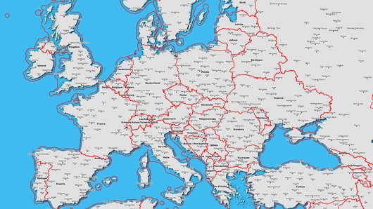
Vasco StreetMaps 12 Ultimate - simply beautiful maps
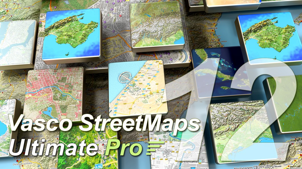
Individual map design pushed to the extreme. "Simply Beautiful maps," the name says it all. It has never been so easy to create customized maps with such a high degree of detail according to your wishes. Our product stands for unlimited possibilities in the design of your maps, in combination with an easy to understand and simple handling.
New: Playing field meets map - a dynamic connection!
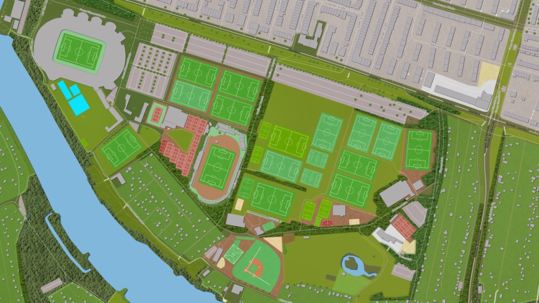
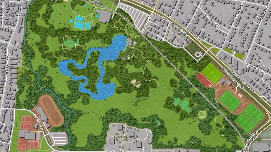
Sports enthusiasts will be thrilled with our new features! From now on you can not only display sports fields on your map, but also the specific markers for soccer, handball, volleyball, basketball, baseball and many other sports. Your maps will become dynamic playgrounds that will inspire you and optimize your planning.
|
New: Bring color and life to your maps |
New: A customized card, exactly as you wish |
|
|
| Vasco StreetMaps has expanded its treasure trove of maps and now offers you a variety of new categories to let your creativity run wild. Swimming pools, miniature golf courses, trees and picturesque rows of trees will make your resorts and recreational facilities shine on the maps. You get the ability to customize your maps and display every detail the way you want. | The clarity of your maps is important to us. Therefore, we have developed an innovative solution to set localities depending on the number of inhabitants. Decide for yourself which localities should be highlighted to get a clear and precise map that perfectly reflects your needs. |
|
New: Smooth transitions without corners and edges |
|
| Dive into a new era of mapmaking with Vasco StreetMaps! With our groundbreaking features, you'll experience maps like never before. Explore the world with smooth transitions that bring forests, meadows and woodlands to life and make the otherwise edgy sterility of maps disappear. Bring your vacation spots to life and give your maps a vibrant, colorful feel that makes you long for travel and adventure. |
|
New: The Magic Editor 2.0 - Your gateway to the perfect map! |
New: Your language, your map! |
|
|
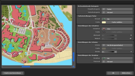
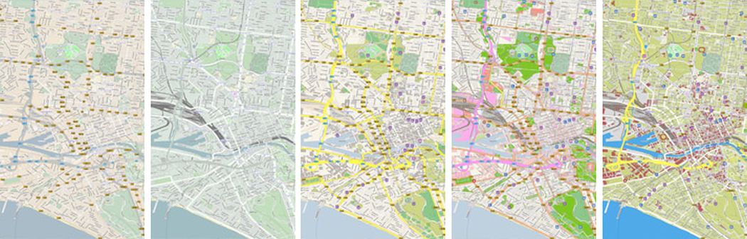
| Individual map customizations in real time! Our MagicEditor has been completely redesigned and now offers an improved category selection for even faster finding of your desired elements. The clarity has been further optimized and the new functions for displaying sports fields make map creation a pleasure. |
We've listened and improved. The selected language setting is now applied to
islands, lakes and other features to give you a consistent experience
throughout. And yes, point markers can now be set for islands and lakes -
precise and impressive! |
|
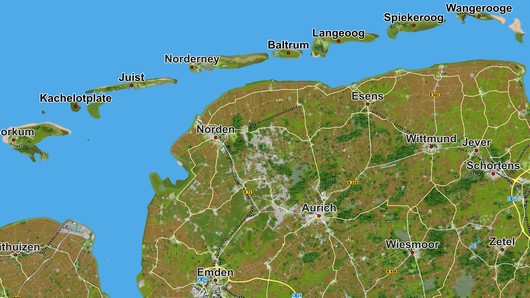
New: Think Big, gigantic amount of new map data |
Elevation data package compressed with the latest technology |

|

|
|
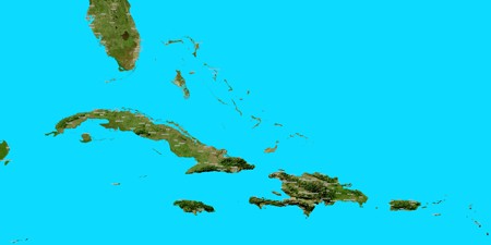
An incredible 22 GB of additional vector data and many gigabytes of
adjustments and changes form the backbone of this fantastic map collection. In combination with the associated satellite and elevation data, Vasco StreetMaps 12 Ultimate now includes a gigantic 338 GB of map data. |
All elevation data has been completely converted to the modern and highly
optimized JPEG XL format. This reduces the amount of data on the hard disk
enormously, while the quality has been improved. In addition, the new JPEG XL format operates in multi-threaded mode, which, in conjunction with the smaller amount of data, results in faster loading and processing times. |
64Bit support - more performance, more memory usage, more possibilities

Thanks to the new 64Bit support of Vasco StreetMaps 12 you can now use the full power of your system to create faster and bigger maps for your travel routes.
More possibilities when creating maps, because no more memory limit due to 32Bit!
|
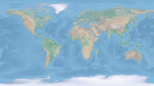
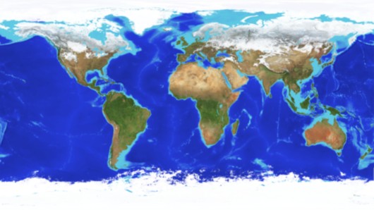
Ocean image, as beautiful as a glowing globe |
More beautiful maps with more beautiful fonts |
|
|
|
The new ocean image, known among other things by the famous glowing globe,
brings you more new possibilities when creating maps. Especially the brighter color choice of the sea gives the maps a whole new splendor. Combine the sea image with any satellite or vector map. |
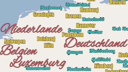
Now use all TrueType and OpenType fonts available in your system to display
text. Choose your preferred font for country names, city names or for other
place names. Design your maps now even more individual with the font of
your choice. Westernstyle, Modern, Futuristic or Antique, everything is
possible. |
Big, bigger, biggest. Giant maps, everything is possible now

Now you can save even huge maps in a single file and edit them with other programs. The important georeferencing is also preserved.
Now you can also realize larger projects with map sizes of over 100,000 pixels as a single tiff file.
Nice Maps, uniquely beautiful maps customized according to your ideas
|
|
|
Turn any map into an impressive masterpiece.
Vasco StreetMaps has no limits in color selection, combination
of vector, satellite and elevation data, adding and removing symbols, fonts,
textures and shadows. Just to name a few of your possibilities.
|
Inspired by the flat maps from Vasco da Gama 15 |
Effective optimizations and useful enhancements |
|

|
|
The new satellite image with the popular color selection, known from the
flat maps (RTU_Maps) from Vasco da Gama 15, now also finds its way into
Vasco StreetMaps.
Now you can create your own map sections or even the whole globe with this beautiful satellite map at any time and use it in Vasco da Gama for your travel route animation. |
Many new highly efficient features speed up calculations for illusion,
shadow and structure effects. Further subtle optimizations to the SQL
database also enable faster loading times. Also the enlarged map tile with up to 16384x16384 pixels for the Big Maps and Tile Maps mode, reduces the calculation of overlaps, which also results in time savings. |
JPEG XL graphics format, highly efficient compression paired with ultra-fast speed

Vasco StreetMaps uses the JPEG XL format not only for its own databases, but now you can also use the highly efficient graphic format for the creation of your maps, for the databases in TMS and SQL (mbtiles) format. Another special feature, the JPEG XL format also supports an alpha channel. Especially in comparison with the PNG format, you can create much smaller files while maintaining the alpha channel.
The clou, JPEG XL is much faster than PNG and also supports multi-core CPUs.
|
Mode change possible at any time |
Landmasks, a clear separation between land and sea |
|
|
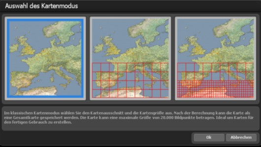
| From now on, Vasco StreetMaps 12 allows you to switch between the 3 modes at any time without losing the map section and the set color scheme. From single map mode to tile mode and back again, no problem. For example, first, create an overview map in single map mode before creating a huge map in tile mode. |
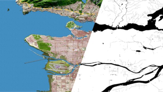
Now, you can also create landmasks, which are black and white maps that
clearly separate the land from the sea. You can easily select your desired
map and automatically generate a map from it without having to make any
further changes. |
|
Winter satellite map for unique winter landscapes |
North Pole map, the sea of snow and ice |
|

|
| Are you going on a winter vacation and need a map that visually depicts winter conditions? Then this winter satellite map is the right choice for you. Especially in combination with the elevation and vector data, you can create particularly impressive maps for your vacation trip. |
Maps often overlook the Arctic at the North Pole, but not anymore. With
Vasco Streetmaps 10, you can now create maps with the full glory of the
Arctic's snow and ice. So it is now also possible for you to perfectly
visualize Arctic expeditions and air travel over the North Pole. |
|
Generate oversized maps as an SQL database |
Progress bar in the taskbar, small but nice |

|
|
| Instead of creating huge maps with thousands of small files, it is now possible to create them as SQL databases (MBTiles format). By having only one file with all the data, you can save space on the hard disk, and if necessary, you can delete the database in a few seconds. |
A small but very helpful feature is the new progress bar in the taskbar.
Creating larger maps can sometimes take longer. If you want to work with
other programs in the meantime, the Vasco StreetMaps window will be placed
in the background. The program icon in the taskbar shows you the current
progress of the calculation so that you can keep track of it at all times. |
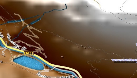
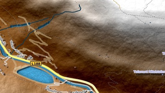
Improved calculation of mountain landscapes even with very high resolutions
|
|
|
|

New features for the calculation of mountain landscapes deliver more beautiful gradients even with very high resolutions. The result is smoother and more natural mountain ranges that combine with satellites and vector data to create beautiful landscapes.
More structures with the Perlin Noise Engine
|
|
|
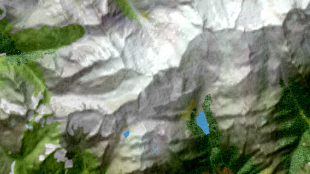
Without Perlin Noise |
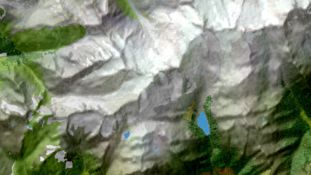
With Perlin Noise |
The Perlin Noise Engine makes the mountain landscapes of your maps look even more realistic and vivid.
Fine textures, through additional information and improved calculation, are now visible through the Perlin Noise Engine.
Country borders can now be switched on/off separately while on the water
|
|
|
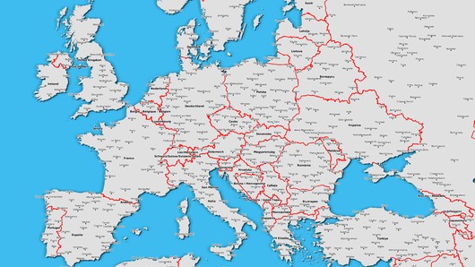
Just as before, you can individually switch country and federal borders on and off. However, now you can also decide if you want to have them displayed on oceans and lakes.
GPS database, known from Vasco da Gama

Benefit from better filtering techniques and more ways to find places. The GPS database, already known from Vasco da Gama, now offers even more GPS points from around the world, so you can find even smaller places that were not previously included.
|
Multi-GPS selection to determine a desired map area |
Importing a GPS track to calculate the map area |
|

|
| Select different GPS points from the database, Vasco StreetMaps 12 will automatically calculate the correct map section so that all GPS points are included on the map. |
You have a GPS track and want to have the map area calculated automatically.
No problem, Vasco StreetMaps 12 now imports your GPS track and automatically
calculates the correct map area so that all GPS points from the track are
included in the map area. |
Ocean background, for clean transitions and more beautiful maps
Vasco StreetMaps 12 now offers you 3 different ways to visualize oceans and lakes. Whether colorful in bright shades of blue or in the colors of the deep blue sea with beautiful turquoise areas or simply in a freely selectable color. It's completely up to you.
Loadable colour schemes
Vasco StreetMaps 12 offers you a variety of mapping colour settings, which gives you enormous flexibility. A large number of loadable colour schemes are included for you to quickly try and use, producing thereby elegant map designs. Naturally, these colour schemes can be adapted and saved as additional template.
Important note:
Vasco StreetMaps 11, Vasco StreetMaps 10, Vasco StreetMaps 9, Vasco StreetMaps 8, Vasco StreetMaps 7, Vasco StreetMaps 6, Vasco StreetMaps 5, Vasco StreetMaps 4, Vasco StreetMaps 3 and Vasco StreetMaps 2 cannot be used (or installed) at the same time! Due to changes in the data structure, this can lead to problems. Older project files from Vasco StreetMaps 6, 7, 8, 9, 10 and 11 can, however, be imported and edited in Vasco StreetMaps 12.
Vasco StreetMaps 12 is delivered as download or on Blu-rays! Therefore a Blu-ray drive is required to install the Blu-rays.
For the download version no Blu-ray drive is required.
Vasco StreetMaps 11 - Video
Romantic encounter in London
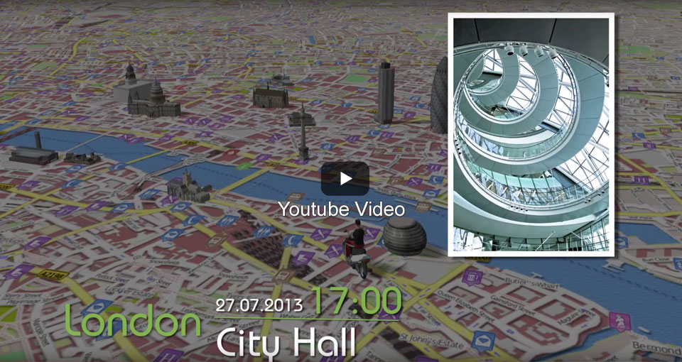
In this video, we show an example of how precisely and effectively Vasco StreetMaps 3 maps can be used in Vasco da Gama 7. The geo-information of the maps is retained despite post-processing in a graphics program. This enables exact route guidance with individually designed map material. In addition to Vasco StreetMaps 3 and Vasco da Gama 7 HD Professional, the object package "Sights of Europe" was used.
Features
Version 3 of Vasco StreetMaps offers a wide range of new features and data. The map design has become even more flexible. In addition, it is possible to load and edit the Vasco StreetMaps 3 maps in a graphics program before importing them into Vasco da Gama, without losing the GPS - data. Create your own maps for Vasco da Gama or for individual use as a stand-alone solution.
A journey from Frankfurt to Cologne
In this video example we show how the maps of Vasco StreetMaps 2 can be used within Vasco da Gama 6, 7,8, 9 (or even Vasco da Gama 5) to create detailed travel animations. Maps were created in different resolutions and transparencies to achieve exactly the level of detail that looks best depending on the mode of travel (plane, car, on foot). In addition, SatMap Professional Germany, Blue Marble NG and various object packages were used.
Demonstration of the zoom factor setting
In this video we show how flexible the resolution can be set when creating maps with Vasco StreetMaps 2. You can generate maps of entire continents as well as high-resolution street maps, setting in detail how exactly the maps should look.
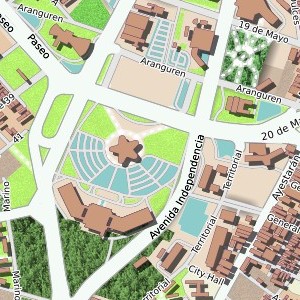
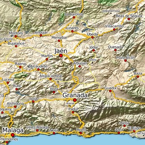
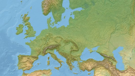
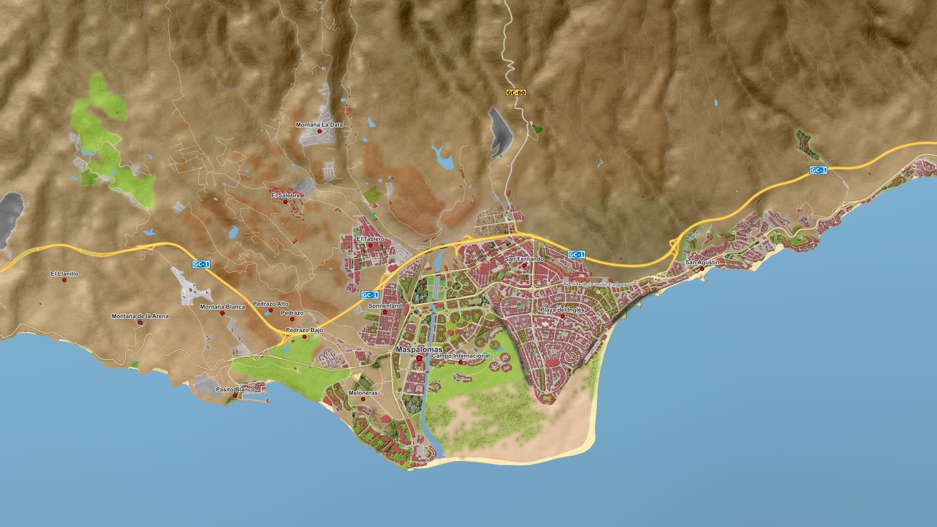
Example maps Vasco StreetMaps
The maps were created with a lower JPG quality, so that the
file size is as small as possible and thus the downloading takes place faster.
| Fonts |
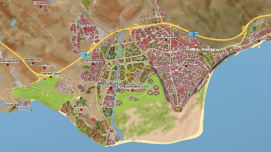
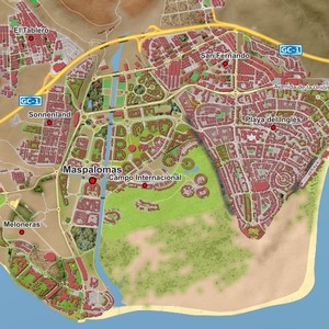
Gran Canaria - Maspalomas |
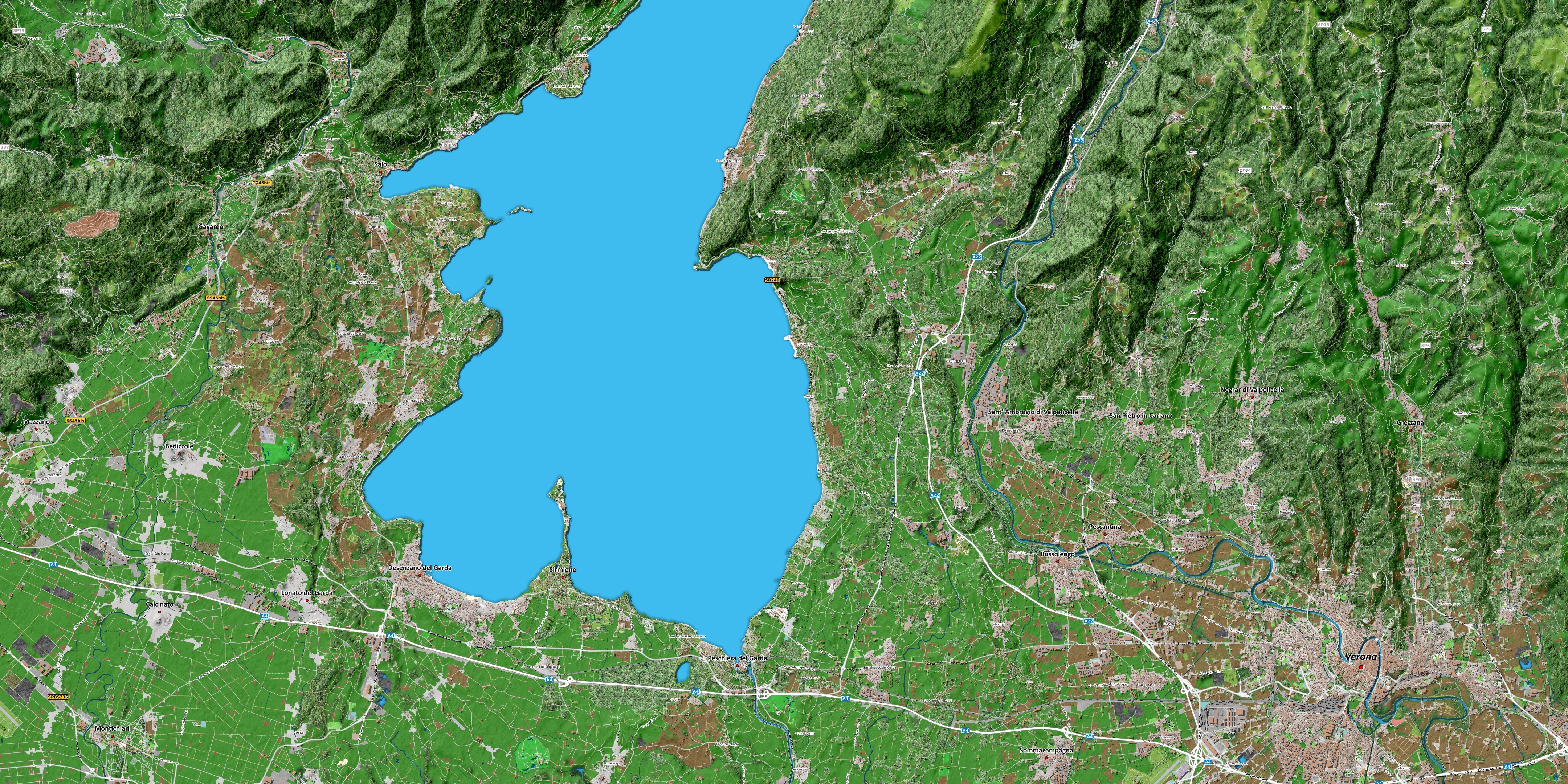
Gardasee
|
 |
 |
 |
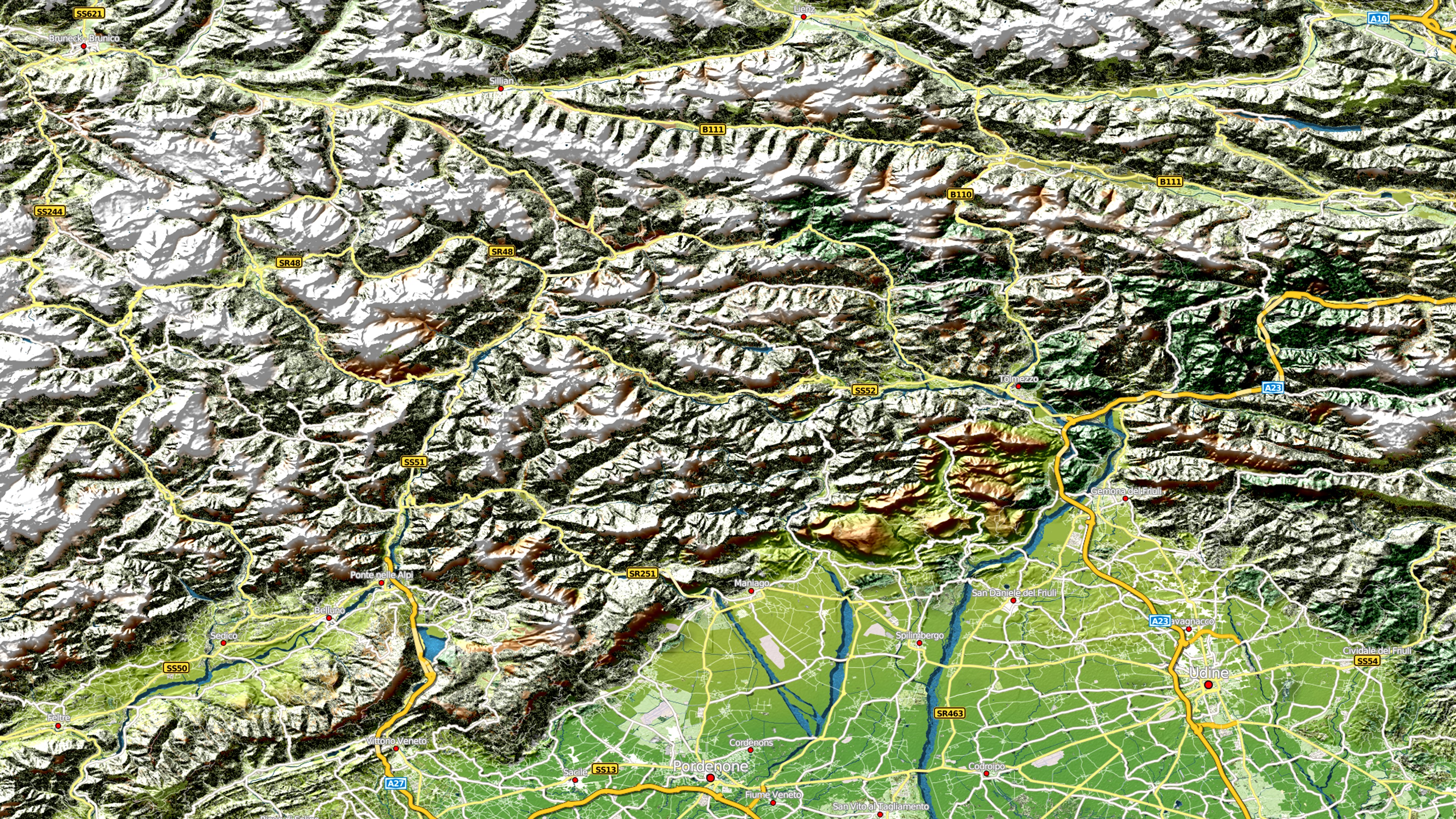
| Alpen |
Bodensee |
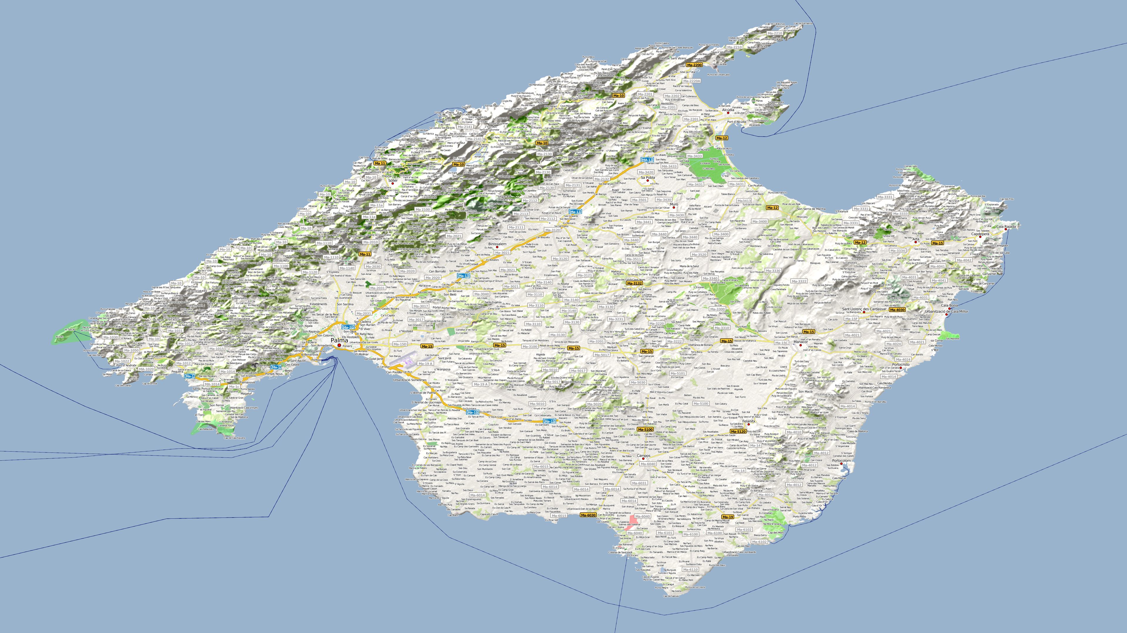
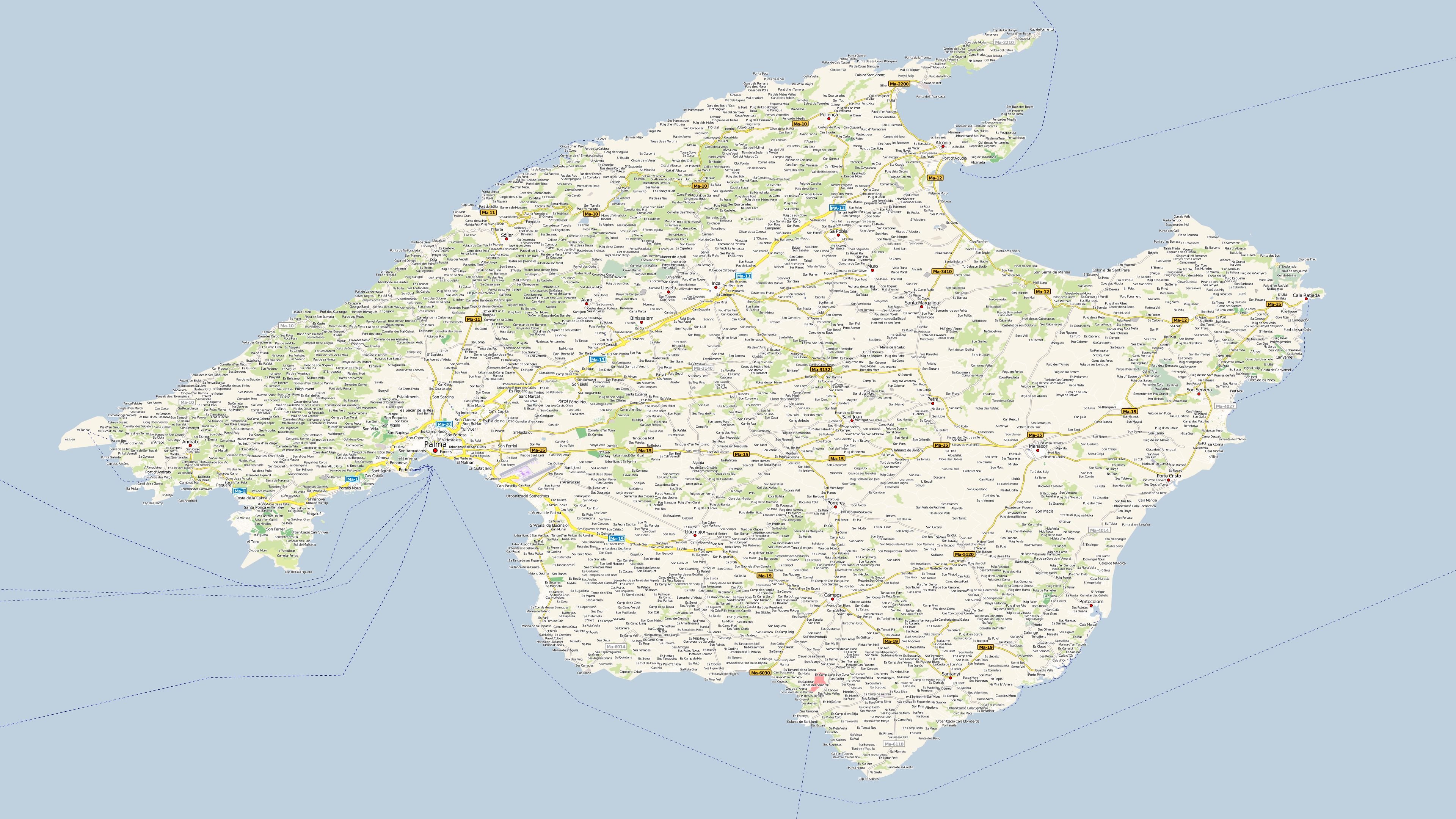
Mallorca
|
 |
 |
 |
|
Map size: 3840x2160 |
Map size: 3840x2160 |
Map size: 3840x2160 |
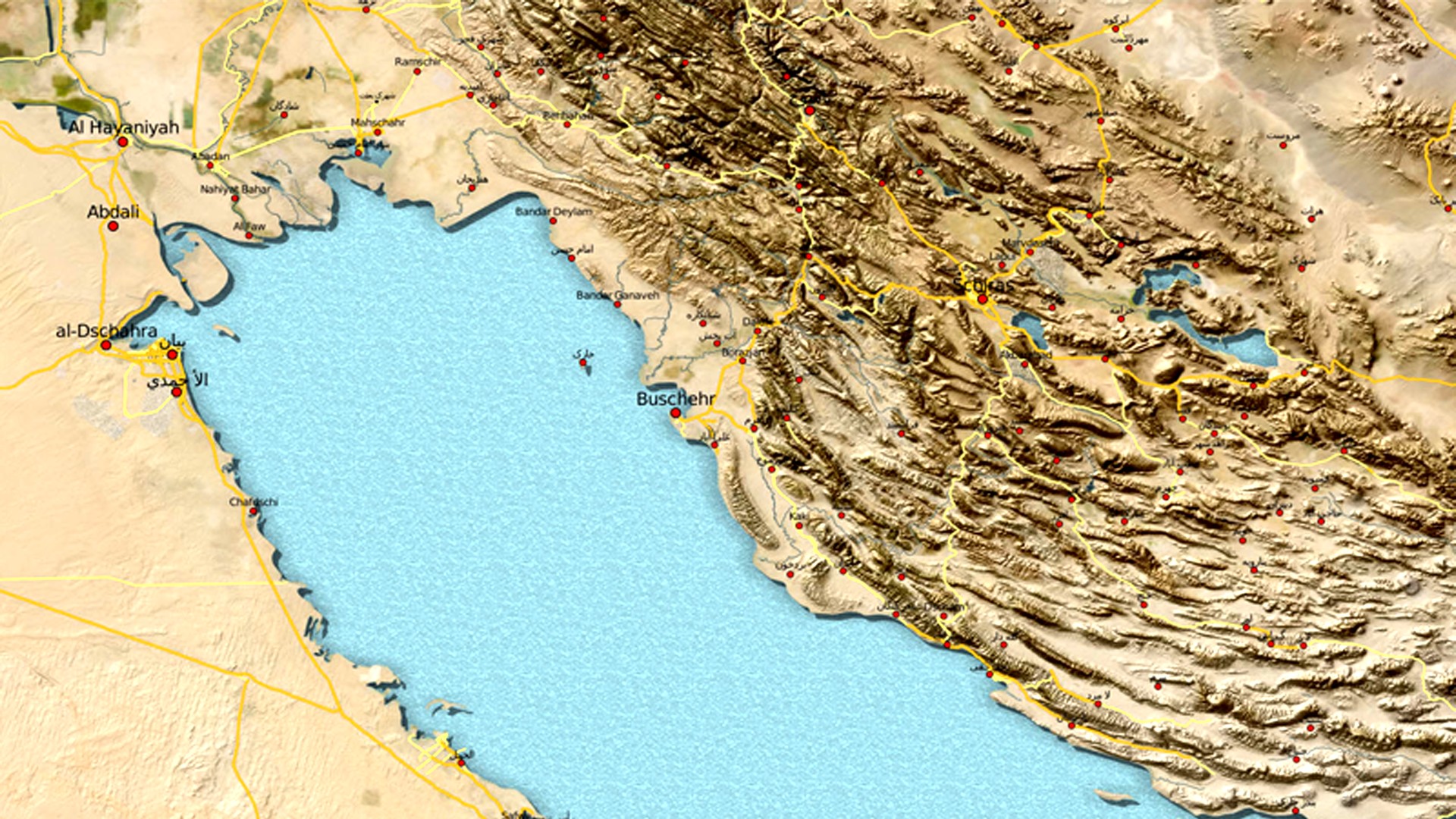
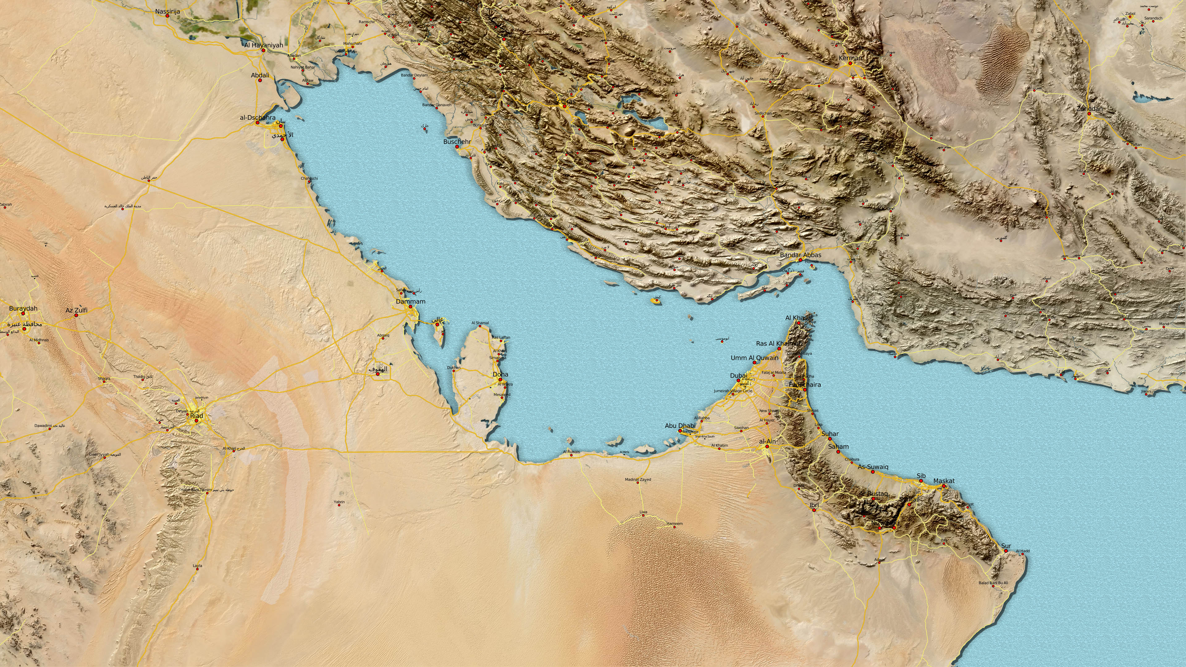
| Persischer Golf |
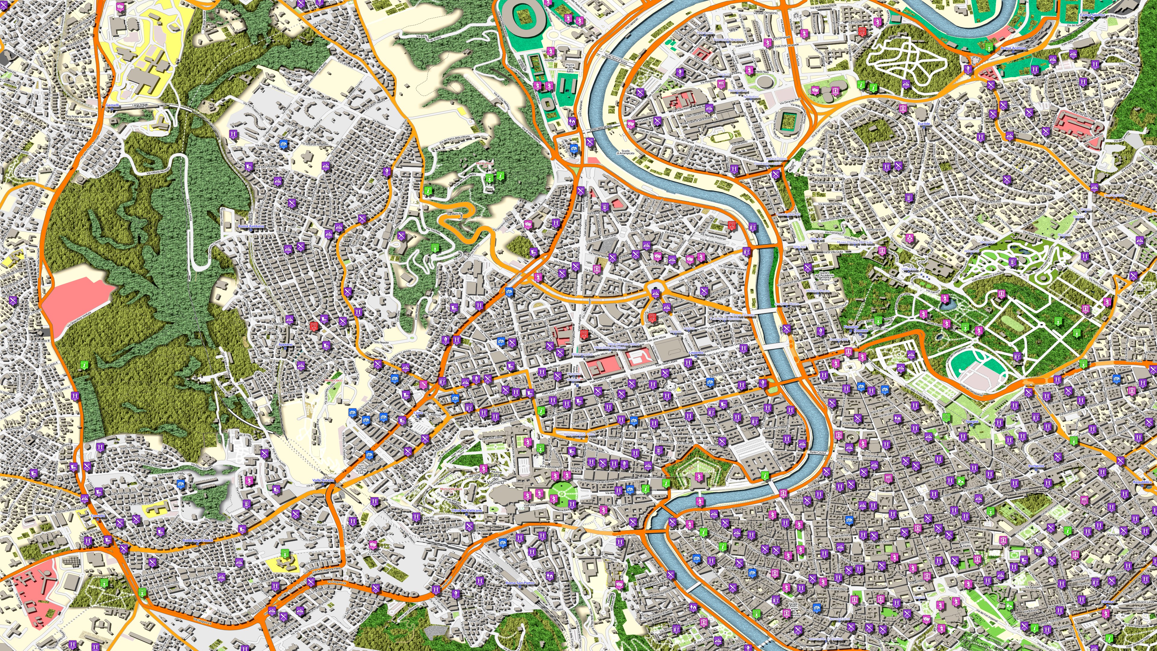
Rom |
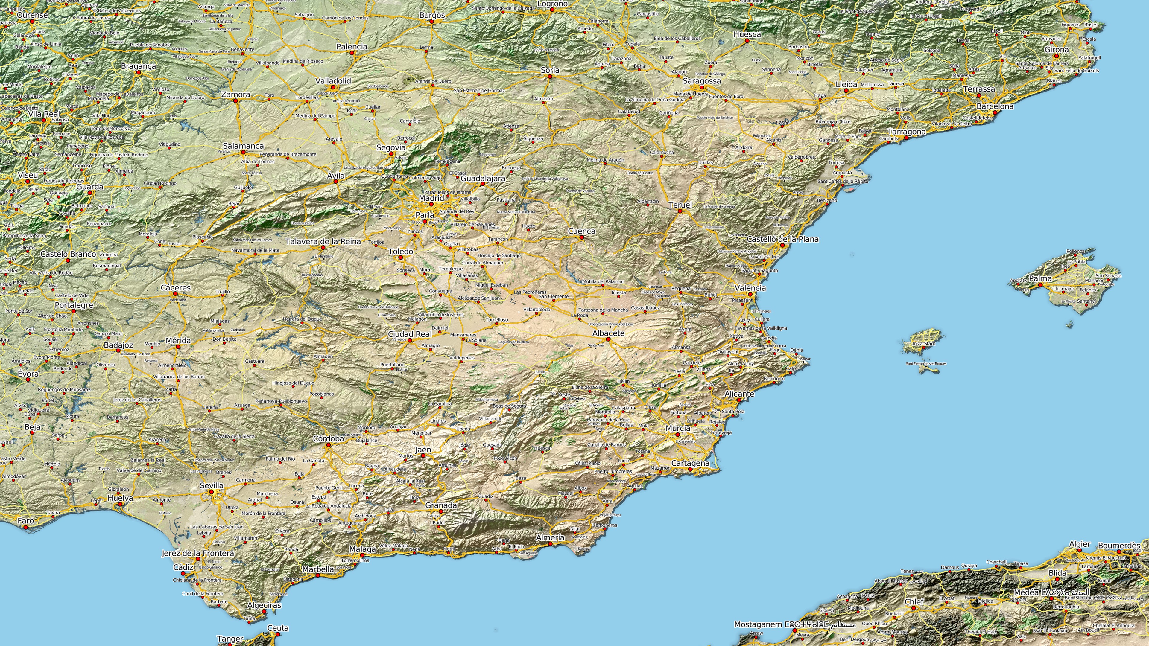
Spanien
|
 |
 |
 |
|
Map size: 1920x1080 |
Map size: 3840x2160 |
Map size: 3840x2160 |
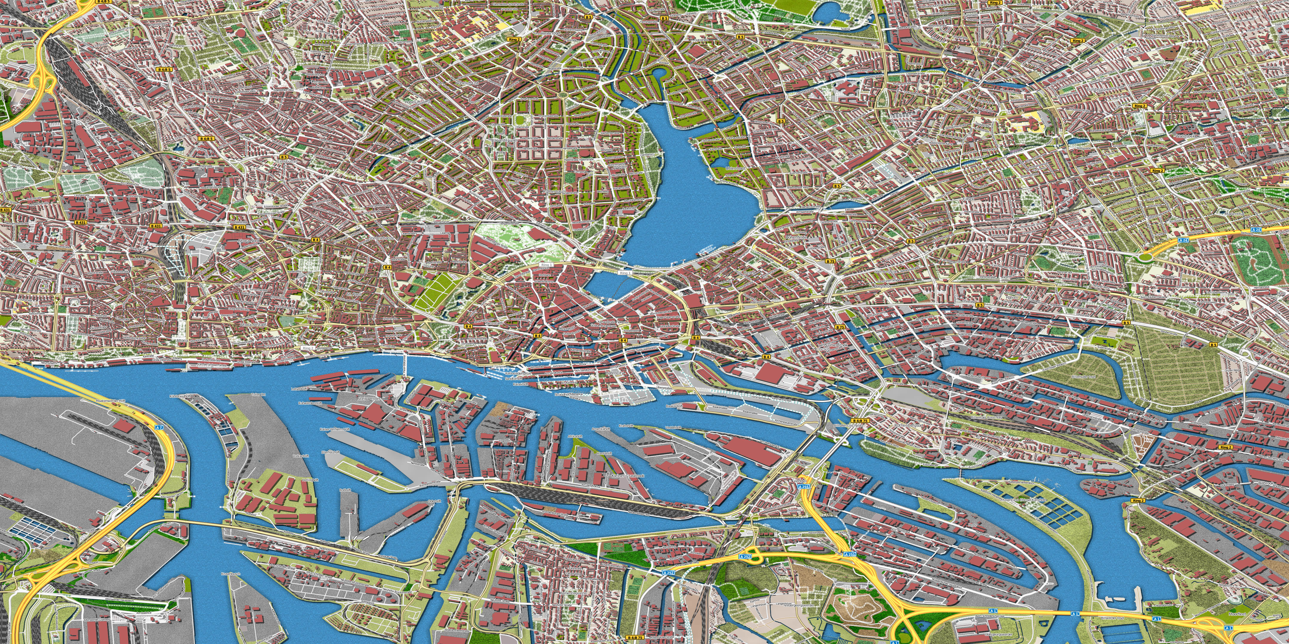
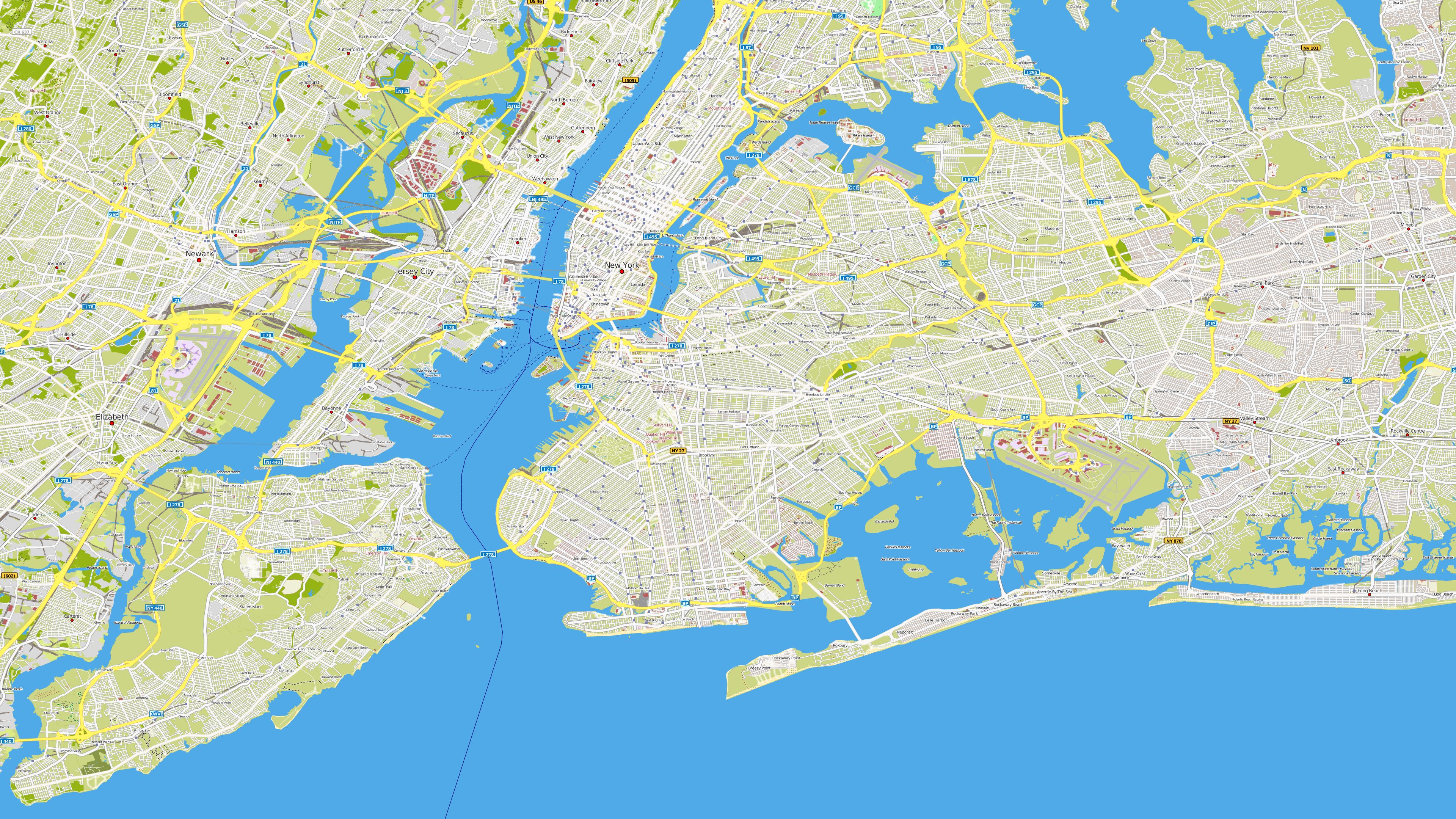
| Hamburg |
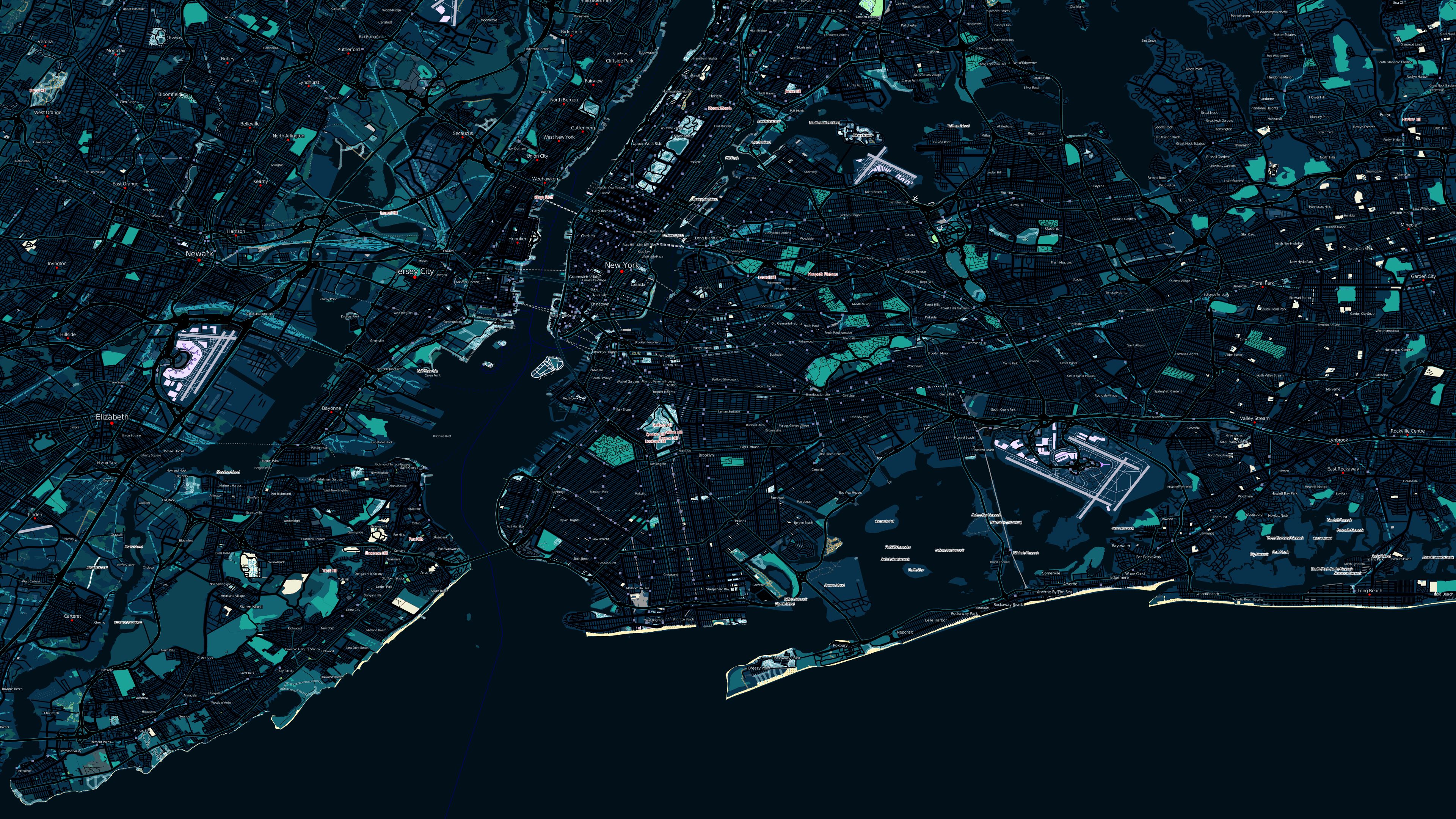
New York
bei Nacht |
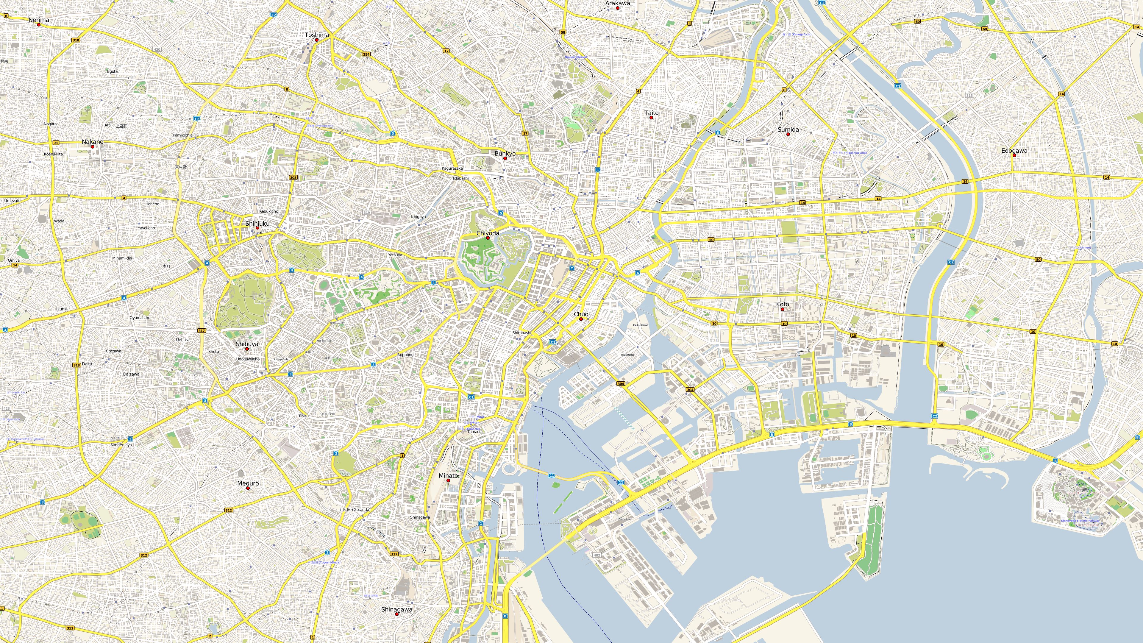
Tokyo |
 |
 |
 |
|
Map size: 4320x2160 |
Map size: 3840x2160 |
Map size: 3840x2160 |
|
|
||
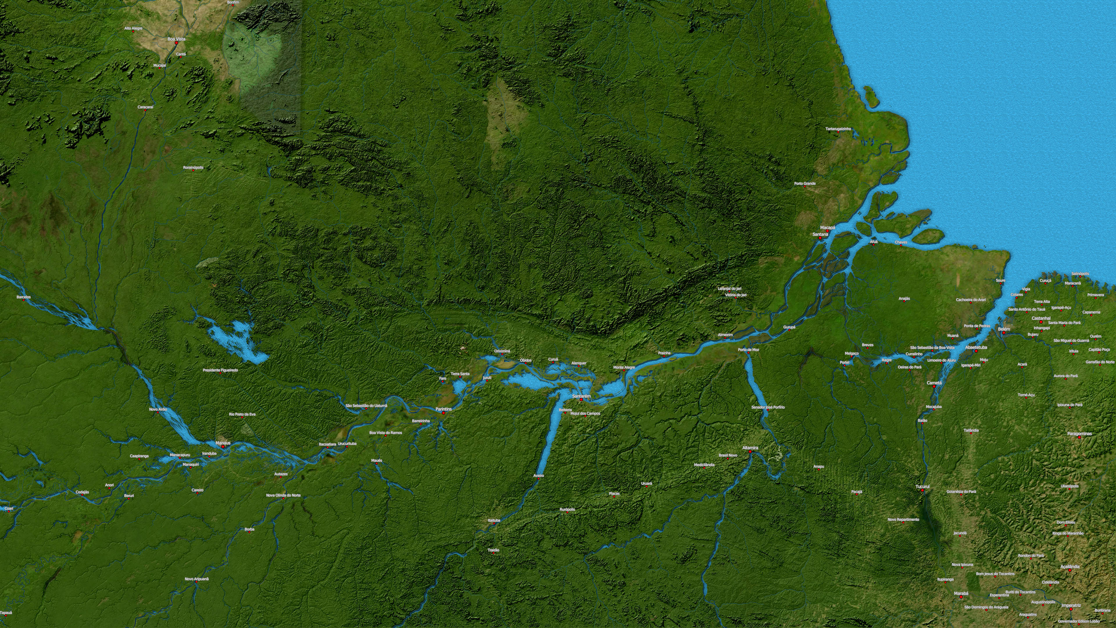
| Amazonasgebiet |
Bremen |
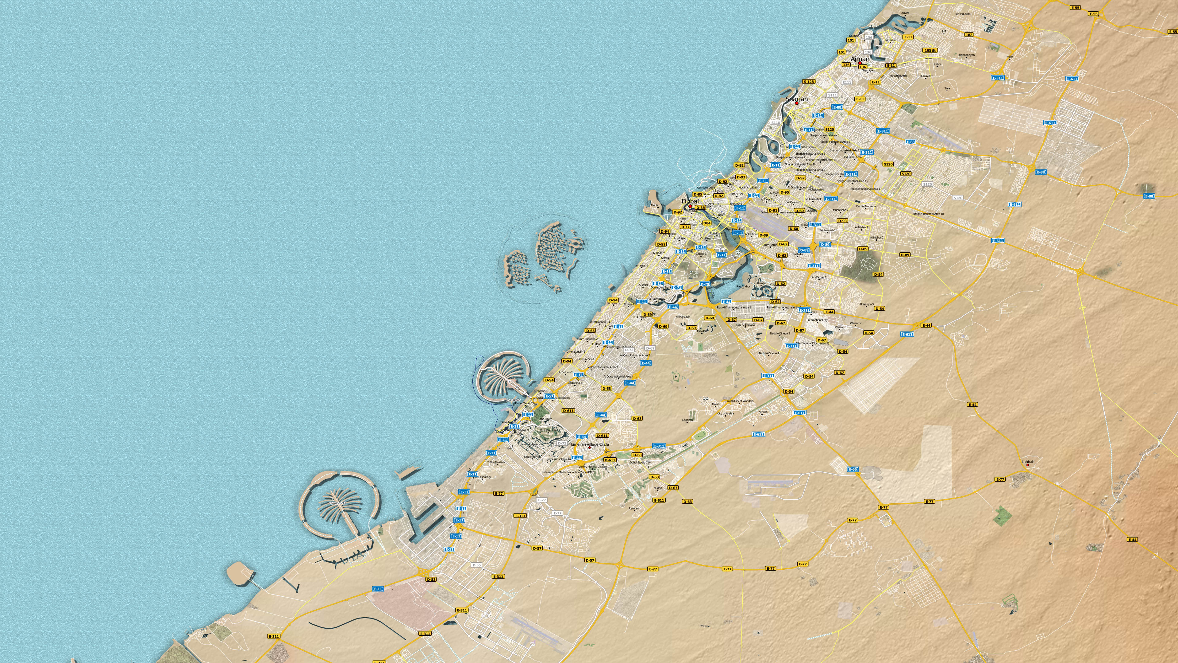
Dubai |
 |
 |
 |
|
|
|
|
|
||
|
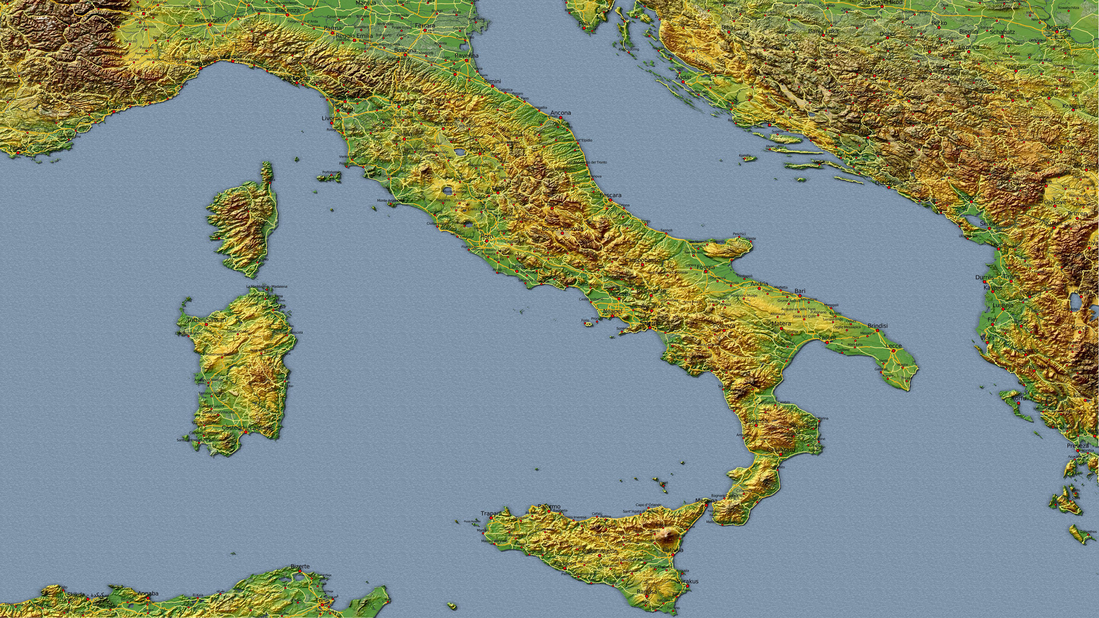
Italien Kombinationsbeispiel 1 mit Satelliten-, Höhen- und Vektordaten |
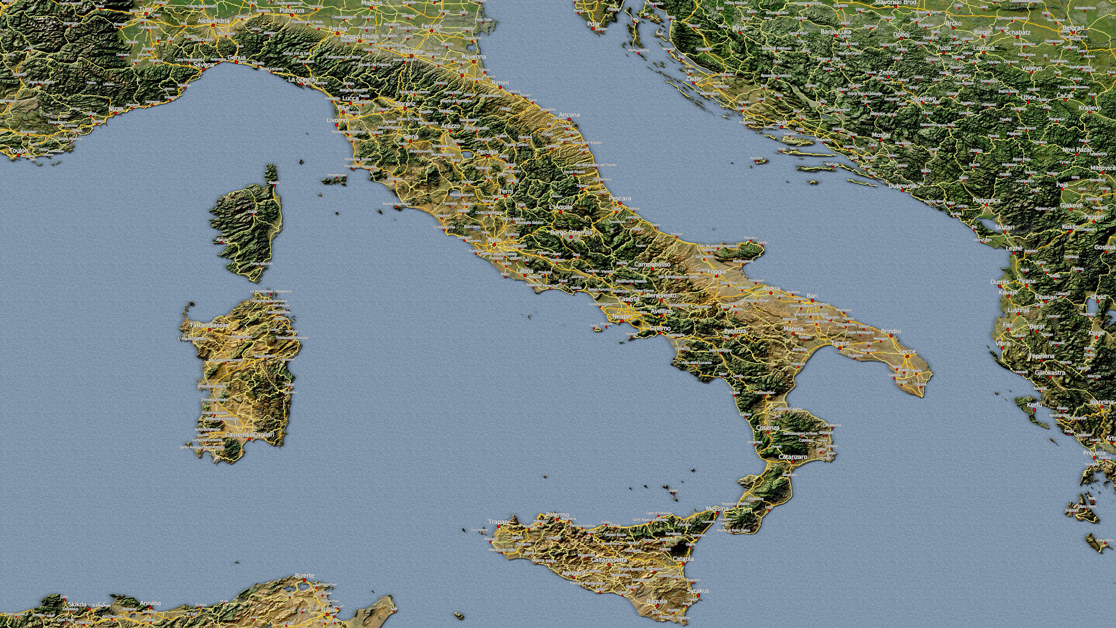
Italien Kombinationsbeispiel 2 mit Satelliten-, Höhen- und Vektordaten |
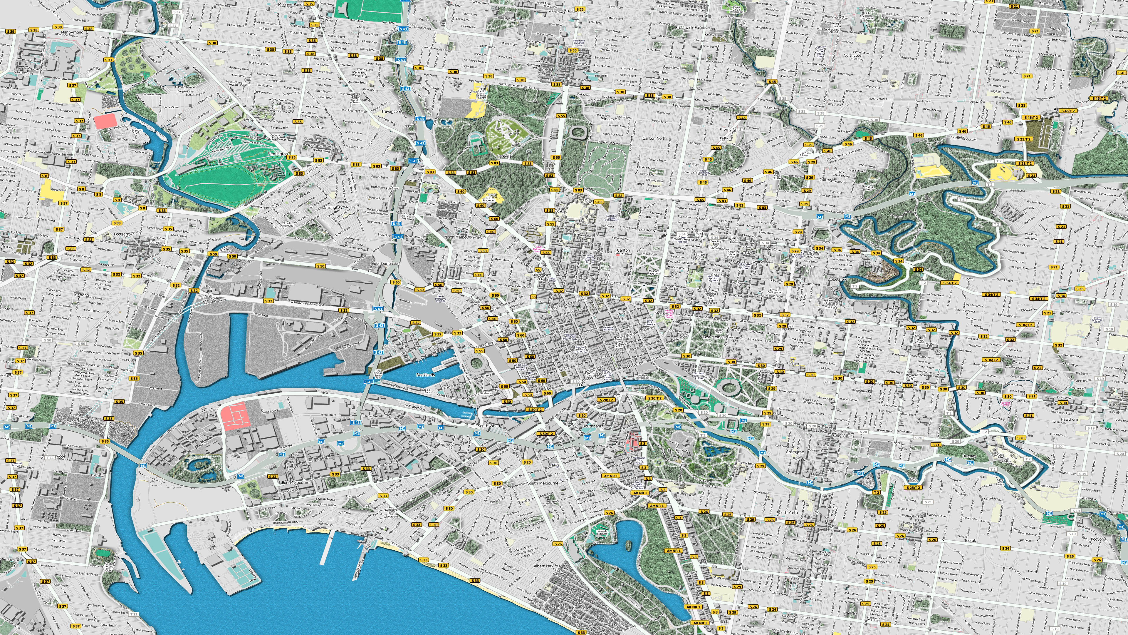
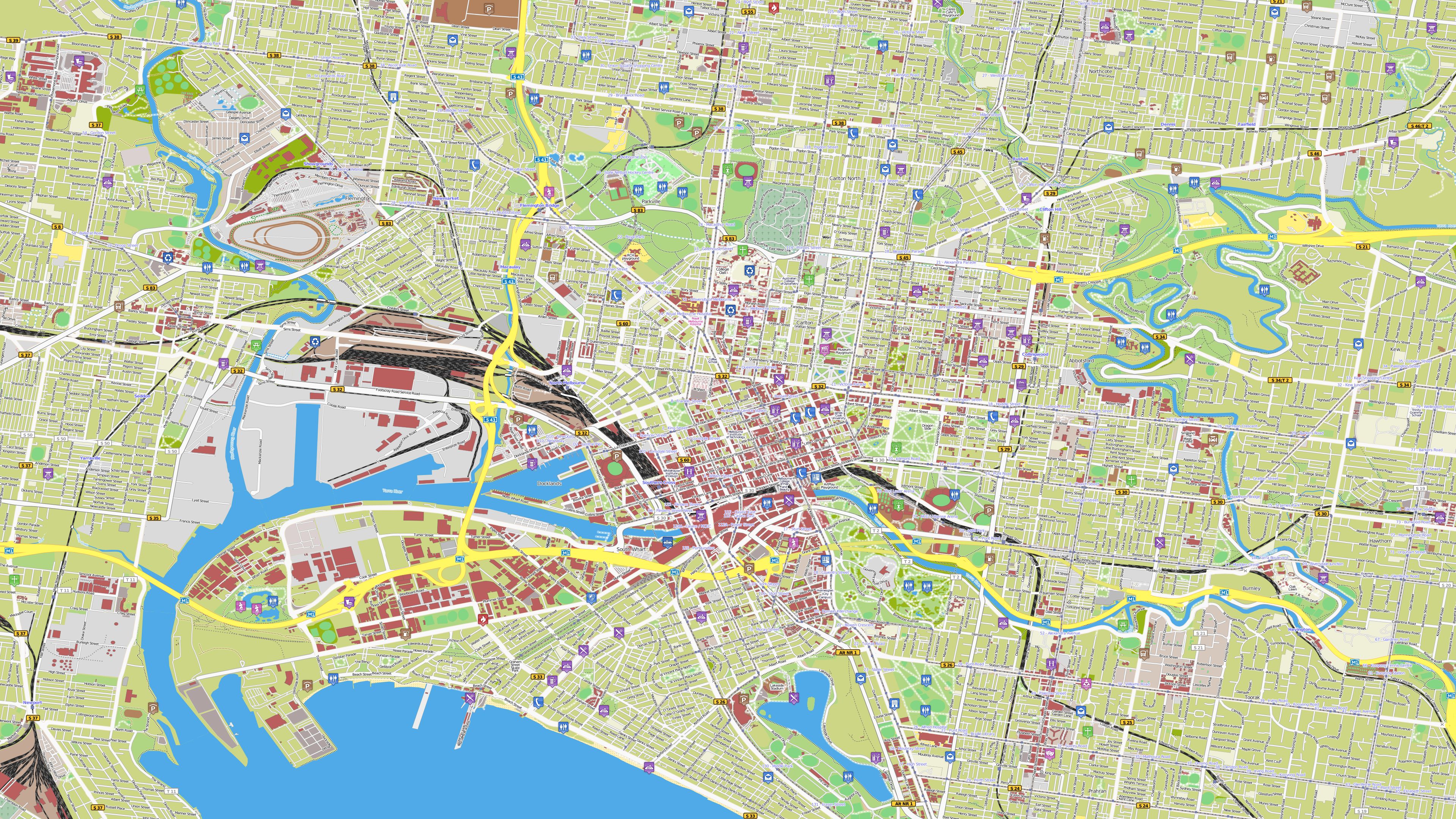
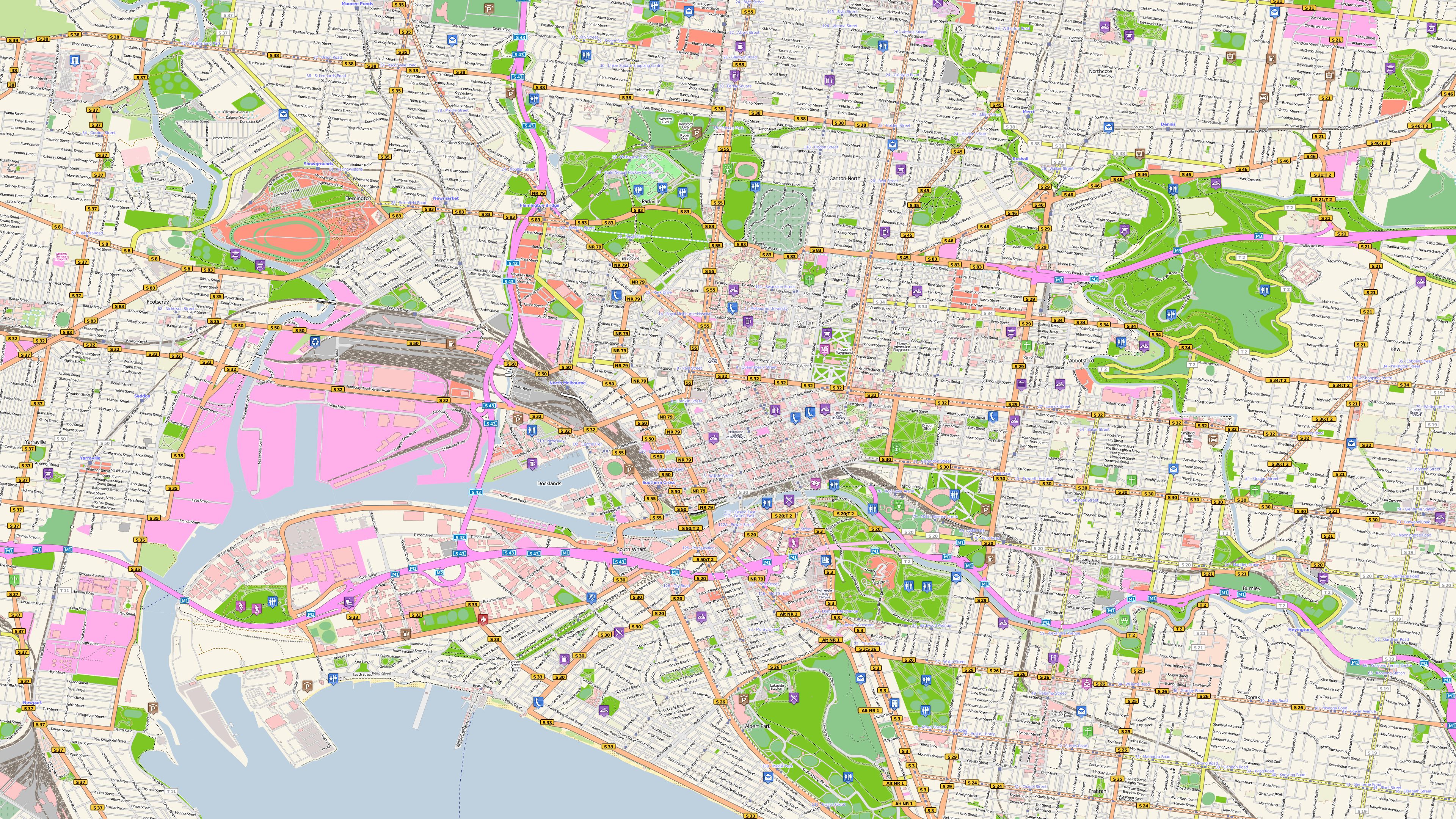
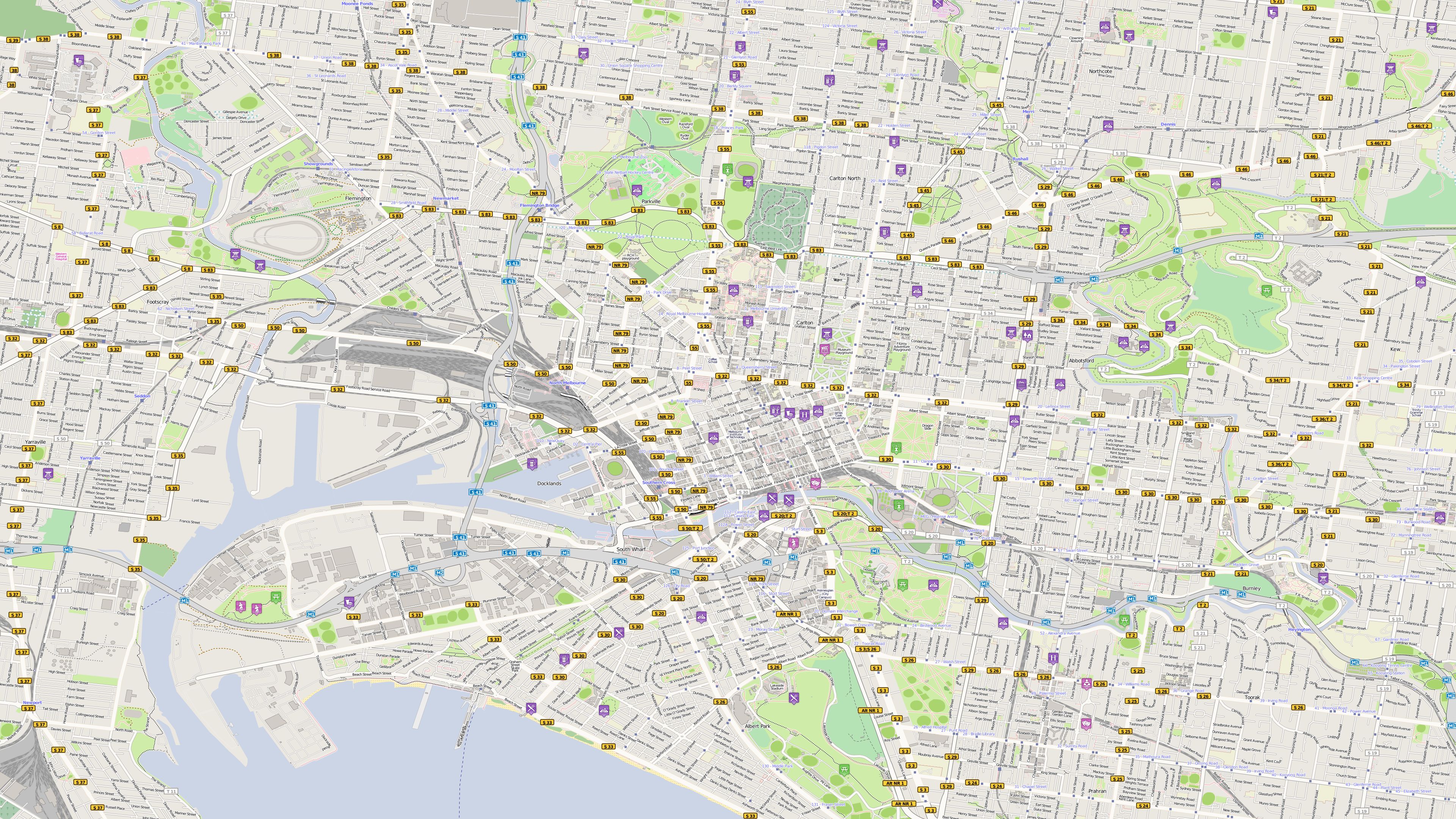
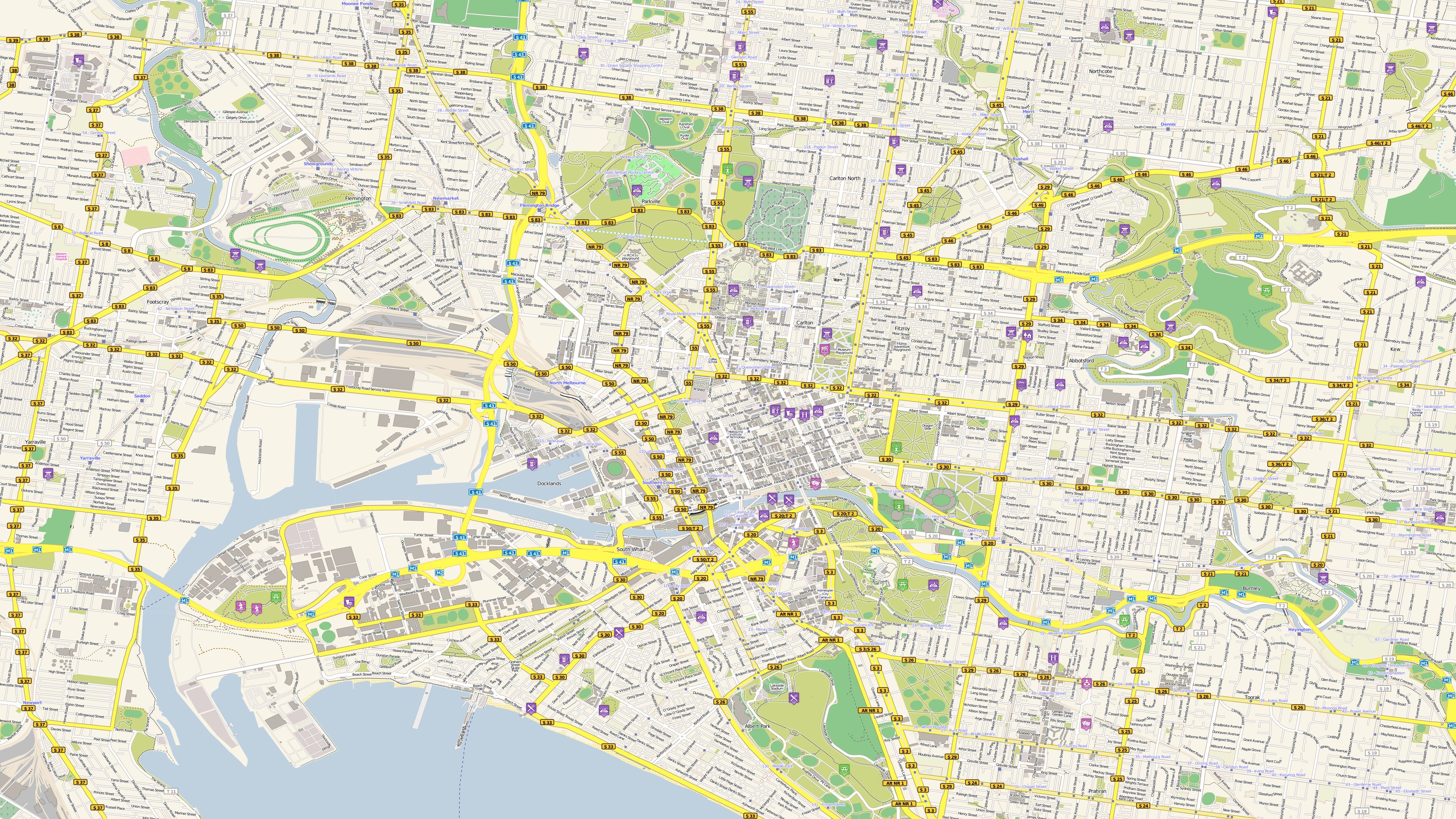
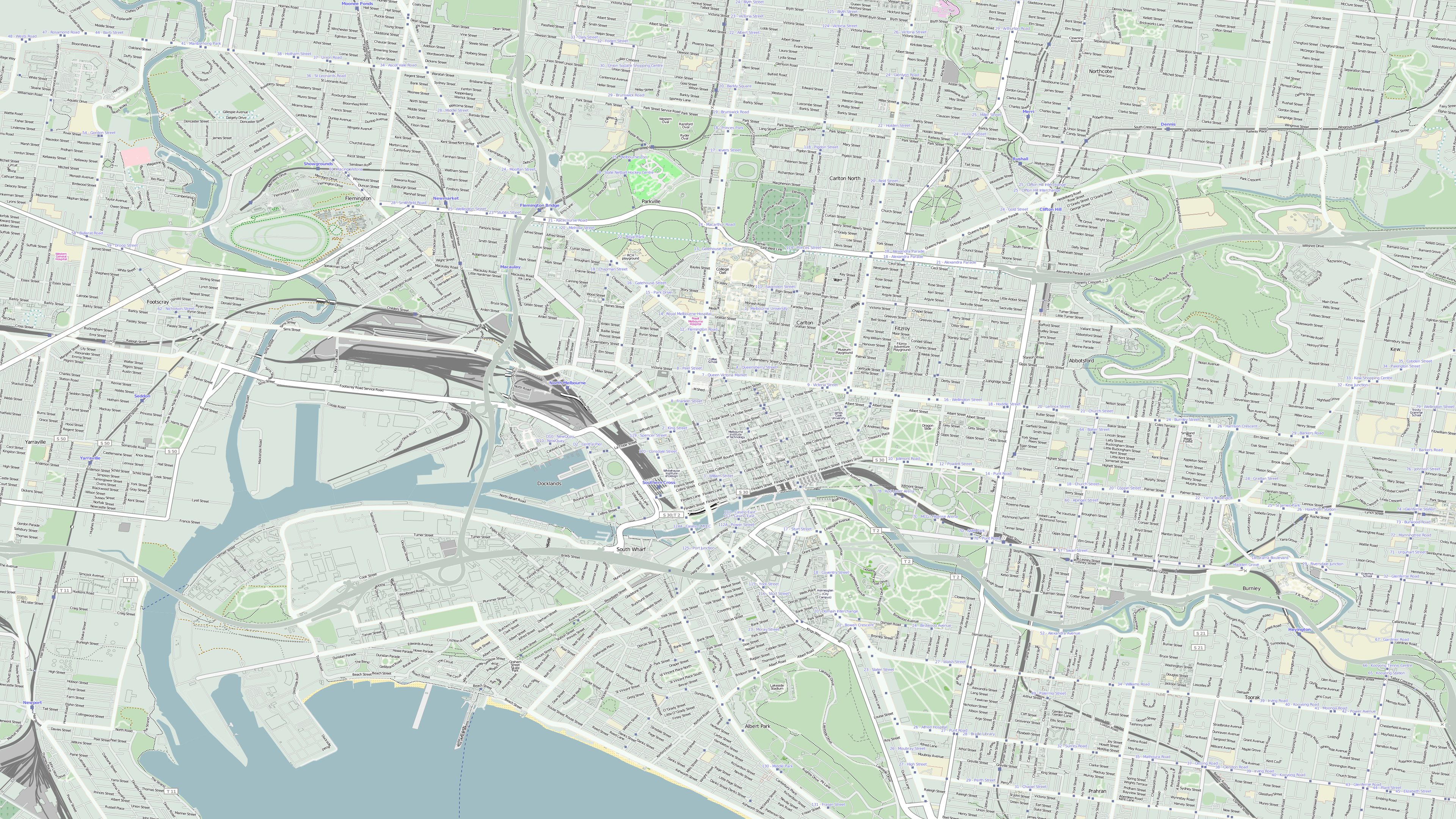
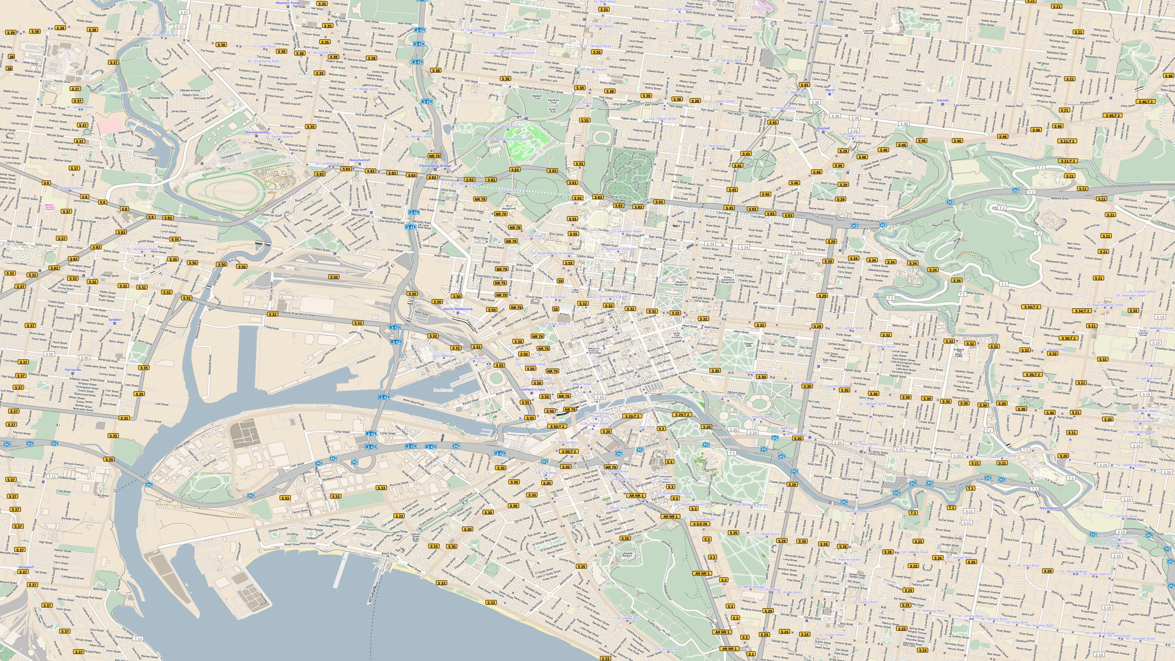
Melbourne |
 |
 |
 |
|
|
|
|
|
||
| Melbourne |
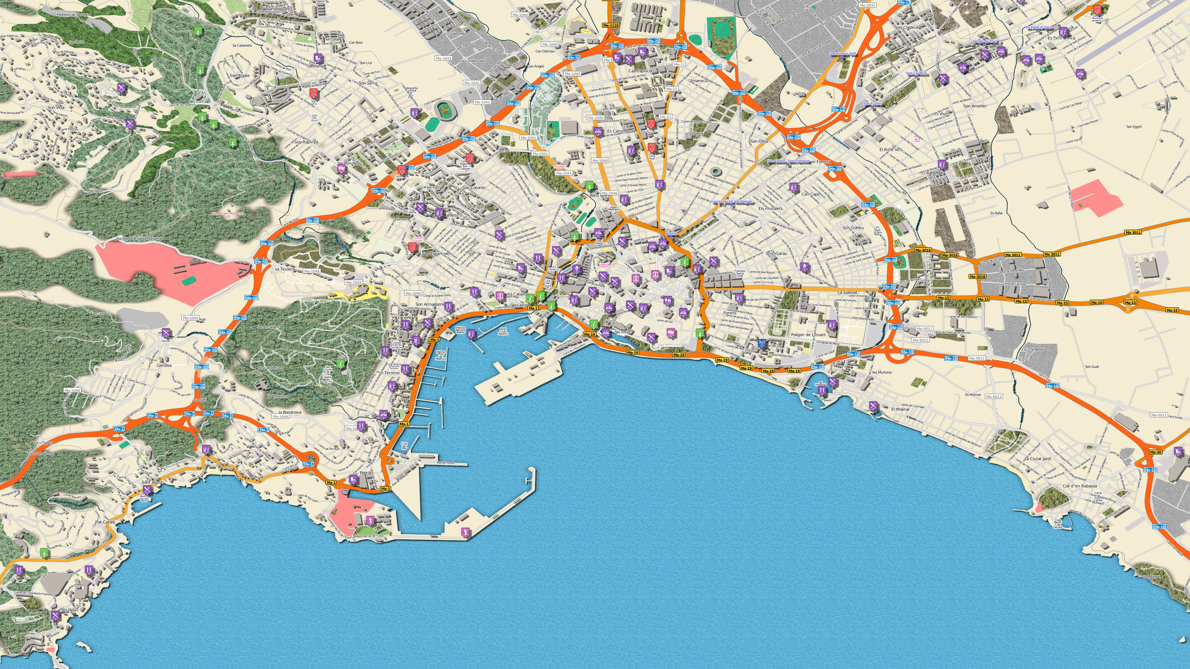
Palma de Mallorca |
Persischer Golf |
 |
 |
 |
|
|
|
|
|
||
| Amazonasgebiet |
Alpen Kombinationsbeispiel 1 mit Höhendaten |
Alpen mit Schnee Kombinationsbeispiel 2 mit Höhendaten |
 |
 |
 |
|
|
|
|
|
||
|
Europa mit deutschen Ortsnamen |
Europa mit internationalen Ortsnamen |
New York am Tage |
 |
 |
 |
|
|
|
|
|
||
| Mallorca |
Mallorca |
Melbourne, Farbbeispiel "Candy" |
 |
 |
 |
|
|
|
|
|
||
|
Melbourne, Farbbeispiel "Fancy" |
Melbourne, Farbbeispiel "Frisches Gelb" |
Melbourne, Farbbeispiel "Mintgrün" |
 |
 |
 |
|
|
|
|
|
||
|
Melbourne, Farbbeispiel "Pastelbraun" |
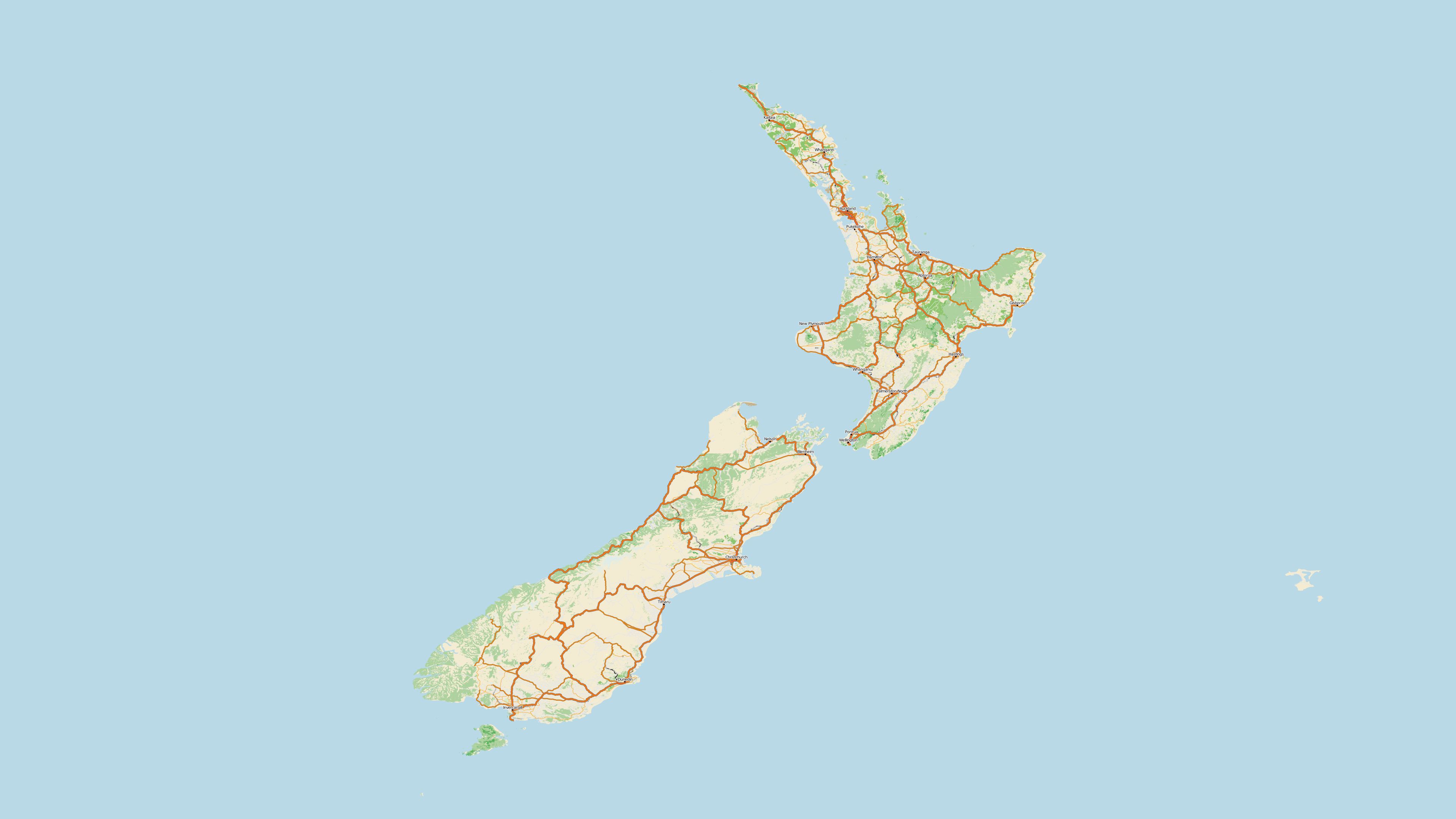
Neuseeland |
|
 |
 |
|
|
|
|
|
|
- Intel® Pentium® IV 1200 MHz or higher
- Microsoft® Windows 7 64Bit, Windows 8 64Bit, Windows 10 64Bit und Windows 11 64Bit
- 8 GByte RAM or higher
- approx. 338 GByte disc space for program installation
- Vasco StreetMaps 12 is delivered as download or on Blu-rays! Therefore a Blu-ray drive is required to install the Blu-rays.
For the download version no Blu-ray drive is required.
You might also be interested in


Learning course Vasco StreetMaps
Other customers have also bought the following items

Lernkurs Vasco da Gama 17
Learning course Vasco StreetMaps

Vasco da Gama 17 HDPro XXL

Learning course Vasco StreetMaps