


Vasco StreetMaps 14 Ultimate Pro - simply beautiful maps
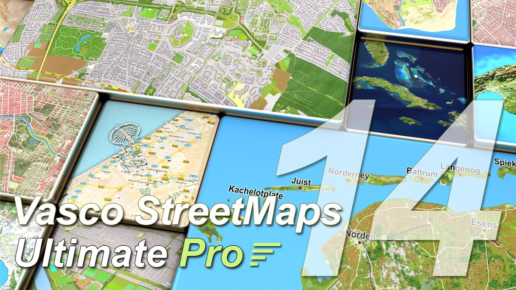
With Vasco StreetMaps 14, every journey becomes a visual experience. Under the motto "simply beautiful maps", the new version not only provides up-to-date and detailed map material, but also offers unlimited design possibilities. Choose your own color scheme, customize fonts, or combine vector data, satellite images, and elevation data to create impressive relief maps - exactly as they suit your story.
Whether it's a spectacular round trip, a great adventure, or your own personal memories, Vasco StreetMaps 14 lets you create the most beautiful maps for your most beautiful journeys. The perfect complement to Vasco da Gama - so your animations are not only informative, but unforgettable.
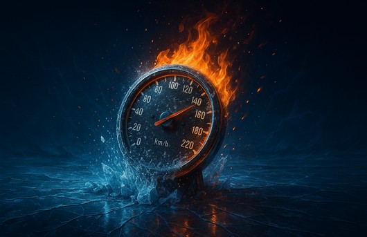
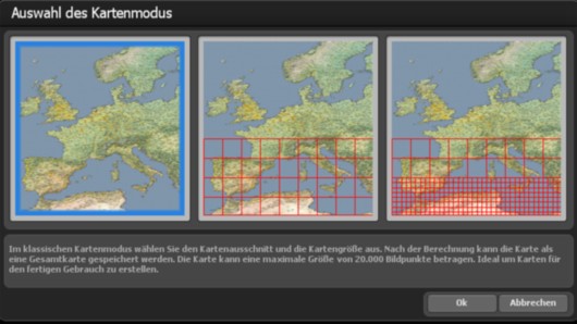
Ultimate Pro - Noticeably more power for your map projectsGet the most out of your computer with Vasco StreetMaps 14 Ultimate
Pro. Using state-of-the-art multi-threading technology, the Pro version
utilizes all processor cores simultaneously - more efficiently and faster
than ever before. The result: your maps are created in a fraction of the
time, even with large amounts of data and complex projects. More power. More speed. More possibilities. |
|
| Criterion | Standard-Version | Ultimate Pro-Version |
| Performance utilization | Uses one CPU core | Uses all CPU cores simultaneously - more efficient, more consistent, faster |
| Project size | Suitable for small to medium-sized projects | Designed for small, large, and extensive map projects |
| Computing time | Good speed with normal maps | Significantly shorter computing times - saves hours to days on large projects |
| System efficiency | Solid performance on common systems | Optimized for modern multi-core processors - gets the most out of your hardware |
| Processing large amounts of data | Possible, with longer waiting times | High speed even with extensive map data and many details |
| Database accesses | Standard speed | Significantly accelerated by Pro-specific optimizations |
| Target group | For occasional use with manageable amounts of data | For anyone who works with maps regularly - efficient and time-saving |
| Return on investment | Good price-performance ratio for simple applications | Maximum benefit with intensive use - quickly pays for itself through time savings |
| Glow and shadow effects | Sufficient for typical applications | Expanded range with greater scope for professional visualizations |
| GPS database entries (cities, towns, capitals) | 365.269 entries - covers the most important places worldwide | 4.526.205 entries - significantly more locations, especially in rural areas |
Ultimate Pro gets more out of your system - and saves you valuable time on
every project.
Significantly shorter calculation times and intelligent utilization of all
processor cores ensure faster results, more efficient calculations, and a
consistently smooth workflow - without any extra effort.
Vasco StreetMaps 14 Ultimate Pro - More power. Less waiting. More enjoyment. The new features at a glance:With Vasco StreetMaps 14, you can experience how modern technology makes all the difference: everything is noticeably faster, smoother, and more reliable. Whether it's intelligent task distribution, modern memory optimization, or the latest processor technologies - everything has been designed to make your work more efficient and enjoyable. The optimized scheduler calculates only the data that is truly relevant, while modern multi-threading and the utilization of all processor cores ensure significantly shorter computing times - even for large projects. Visual effects such as glow, blur and Perlin noise can also be implemented faster and more beautifully. SatMapPro 2 expands your possibilities with detailed satellite images - ideal for impressive maps of all kinds. The whole thing is rounded off by a modern color scheme with optional dark mode. This allows you to work not only faster, but also more relaxed - and concentrate fully on the essentials. |

|
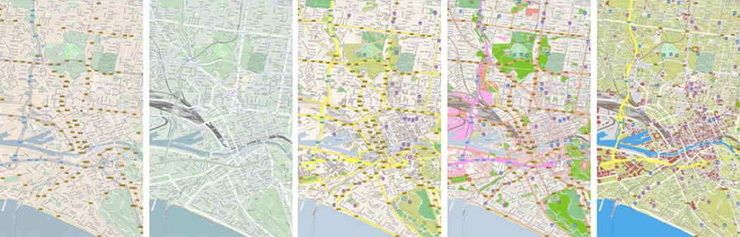
New: New color scheme - modern look, better readability
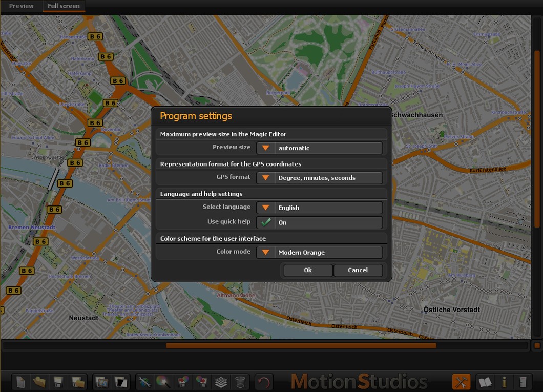
Our new user interface features a modern color scheme with
improved contrast, which significantly increases readability. You can easily
choose between the classic and the new dark mode design - whichever suits your
taste and preferences. This makes working with Vasco StreetMaps 14 even more
enjoyable.
|
New: Scheduler - Intelligent task distribution for noticeably faster performance |
New: Optimized memory management - Efficiency at all levels |

|
|
| The new scheduler ensures that only the truly relevant areas are calculated. This conserves resources and significantly increases speed. The result: faster, smoother results - without any annoying waiting times. | Thanks to modern memory management, resources are now used in a more targeted manner. No unnecessary caching, no overload - just maximum speed with minimum memory consumption. |
|
New: Think Big - Maps that reflect the latest changes in the world |
New: Multi-threading instead of multi-processing - More performance, less memory requirements |

|

|
|
The world changes every day - new roads are built, routes change, places
grow. With Vasco StreetMaps 14, you always have your finger on the pulse of
these changes. Our maps are comprehensively updated and offer you the best
possible display. Over 30 GB of new and updated data ensures that you won't miss a single new road and will always be well oriented - no matter where your journey takes you. |
We have switched from multi-processing to multi-threading. This means less
memory consumption and significantly higher speed. Your work will be done
faster and more smoothly, allowing you to focus on what's important. |
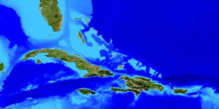
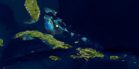
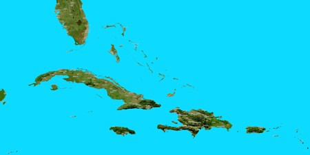
New: SatMapPro 2 - Realistic map views for land and sea
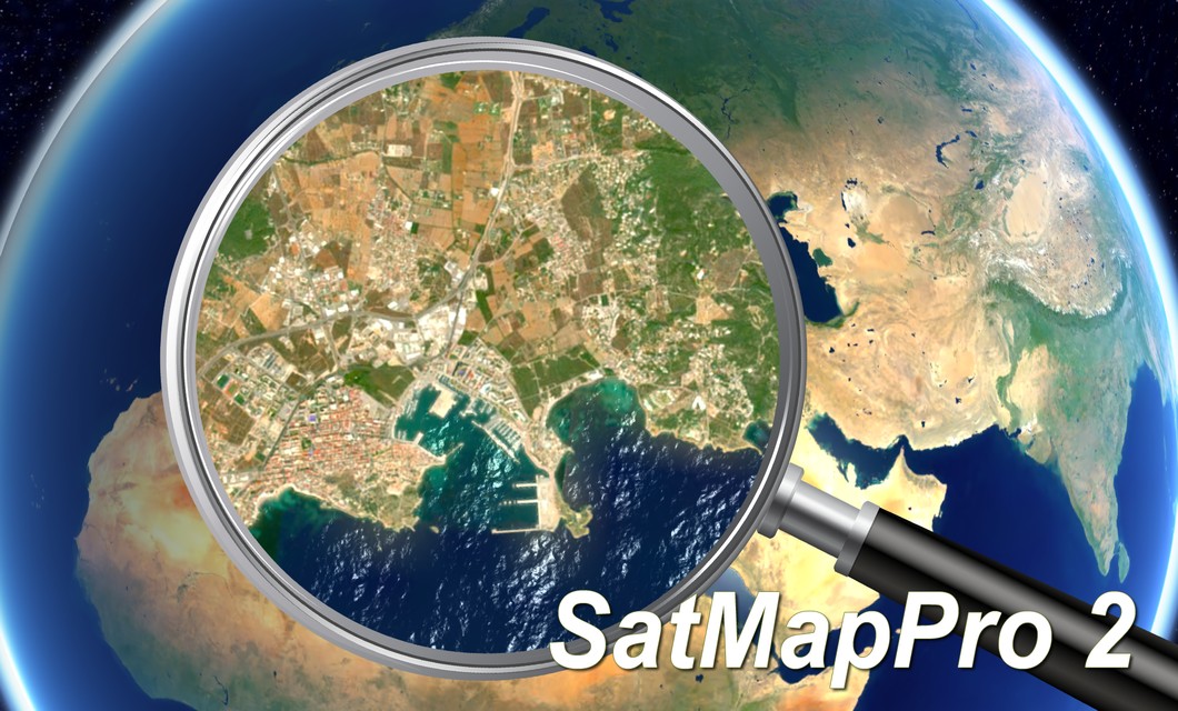
The seamless integration of SatMapPro 2 into Vasco StreetMaps 14 opens up completely new perspectives. This extension allows you to integrate high-resolution satellite images of both land and sea areas directly into your map projects. Whether you want to display detailed landscapes, coastlines, or maritime routes, SatMapPro 2 provides you with the right visual data in impressive quality.
The realistic representations help you to make your projects even more vivid and informative. This feature is a significant enhancement, especially for users who value precise and aesthetically appealing maps.
What's more, you can use the maps you create not only within Vasco StreetMaps 14. The maps are also ideal for other purposes, such as postcards, overview maps, or editing with other programs. This gives you flexibility and allows you to get the most out of your map projects.
Please note that the full version of SatMapPro 2 is required
to use SatMapPro 2 in Vasco StreetMaps 14. If you already have this, you can
easily activate the extension and immediately benefit from the advanced features.

|
New: Modern multi-threading optimization for maximum speed Thanks to the integration of Intel's ApiOne, all calculations benefit from modern multi-threading and SIMD techniques. This makes Vasco StreetMaps 14 faster and more efficient than ever before.
With modern algorithms and optimized multi-core techniques, smooth glow and blur effects can now be calculated much faster. This makes everything look much more beautiful and harmonious - and your computer remains pleasantly fast.
Previously, the Perlin Noise library had to recalculate every detail. With the new Perlin Noise Map, we get around this: data is loaded directly and processed at lightning speed. This results in a huge performance boost while maintaining the highest quality.
Our optimizations in JXL encoding ensure that your images are now processed up to 4x faster and with higher quality. This allows you to enjoy first-class quality without compromising on speed.
Vasco StreetMaps 14 uses modern processor functions such as AVX2 and AVX512 to perform many calculation steps with a single, particularly efficient command. What used to require numerous individual steps now takes a fraction of the time. You'll notice it immediately: everything runs more smoothly and faster - without any extra effort on your part. |
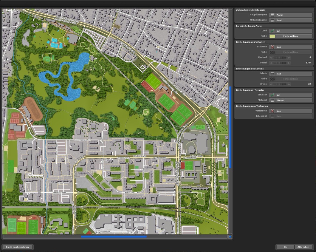
Your wish has been granted: Discover the new color scheme preview of Vasco StreetMaps 14!
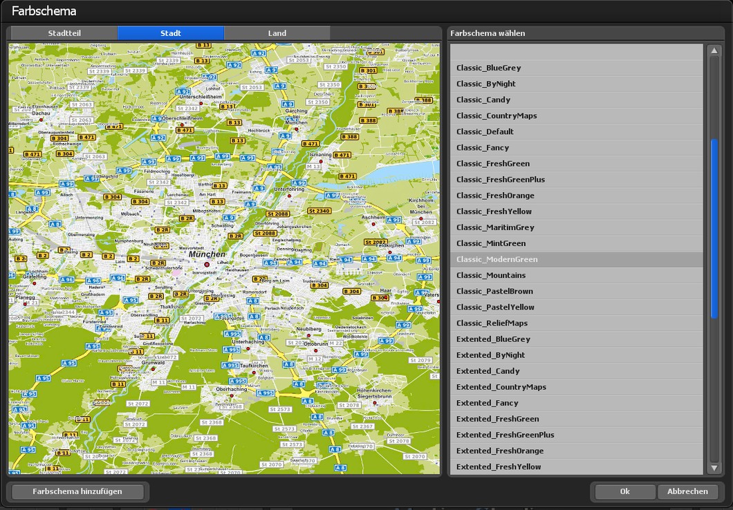
Many of you have asked for it and we have responded to your request. With Vasco StreetMaps 14, you can now choose from different color schemes (presets) and find your preferred variant for maps more quickly thanks to the practical preview. Three preview variants are available for each color scheme - district, city and country. This makes it quick and easy to find the right color scheme for your individual maps.
|
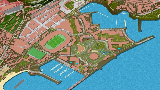
More details and lively harbor views |
Natural beauty |
|
|
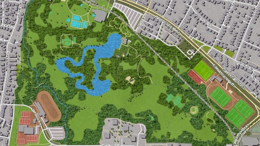
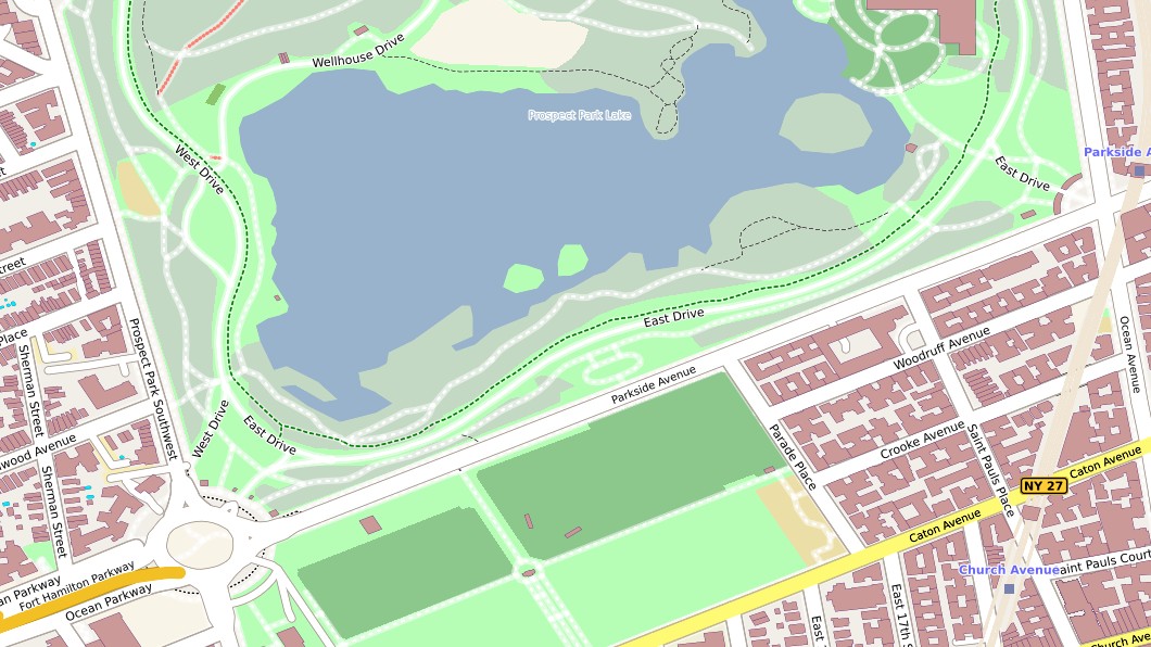
| Vasco StreetMaps 14 provides you with a large amount of data that offers you many new details. Particularly in the area of harbors, harbor dams are now also displayed. Another highlight is the ability to display jetties. This makes the harbor area look much livelier and you can dock your sailing ship directly. | With the new version of Vasco StreetMaps 14, you can create maps that look even more natural. Thanks to smooth transitions and natural fraying between different categories, the edges of forests and meadows appear more realistic. No more angular or angular boundaries, your maps will be harmonious, impressive and beautiful to look at. |
Customization made easy with the new Magic Editor V3.0
The new Magic Editor V3.0 of Vasco StreetMaps 14 allows you to customize your maps quickly and easily. The extended version offers more space for the preview display and the window size is automatically adjusted so that you always have the best overview. Customize your map even faster and more precisely to your wishes. Of course, you can also adjust the preview size to your preferences at any time in the main settings.
|
Bring color and life into your maps |
Elevation data package compressed with the latest technology |
|
|
| Vasco StreetMaps has expanded its treasure trove of maps and now offers you a variety of new categories that give your creativity free rein. Swimming pools, mini-golf courses, trees and picturesque rows of trees let your vacation resorts and leisure facilities shine on the maps. You get the opportunity to customize your maps and display every detail the way you want it. |
All elevation data has been completely converted to the modern and highly
optimized JPEG XL format. This reduces the amount of data on the hard disk
enormously, while the quality has been improved. In addition, the new JPEG XL format operates in multi-threaded mode, which, in conjunction with the smaller amount of data, results in faster loading and processing times. |
|
Smooth transitions without corners and edges |
|
| Dive into a new era of map creation with Vasco StreetMaps! Experience maps like never before with our groundbreaking features. Explore the world with smooth transitions that bring forests, meadows and woodlands to life and remove the otherwise angular sterility of maps. Bring your vacation destinations to life and give your maps a vibrant, colorful atmosphere that awakens the longing for travel and adventure. |
|
Playing field meets map - a dynamic connection! |
Your language, your map! |
|
|
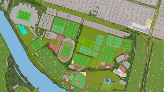
| Sports enthusiasts will be thrilled with our new features! From now on you can not only display sports fields on your map, but also the specific markers for soccer, handball, volleyball, basketball, baseball and many other sports. Your maps will become dynamic playgrounds that will inspire you and optimize your planning. |
We've listened and improved. The selected language setting is now applied to
islands, lakes and other features to give you a consistent experience
throughout. And yes, point markers can now be set for islands and lakes -
precise and impressive! |
|
Ocean image, as beautiful as a glowing globe |
More beautiful maps with more beautiful fonts |

|
|
|
The new ocean image, known among other things by the famous glowing globe,
brings you more new possibilities when creating maps. Especially the brighter color choice of the sea gives the maps a whole new splendor. Combine the sea image with any satellite or vector map. |
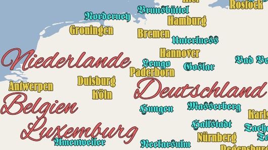
Now use all TrueType and OpenType fonts available in your system to display
text. Choose your preferred font for country names, city names or for other
place names. Design your maps now even more individual with the font of
your choice. Westernstyle, Modern, Futuristic or Antique, everything is
possible. |
Nice Maps, uniquely beautiful maps customized according to your ideas
|
|
|
Turn any map into an impressive masterpiece.
Vasco StreetMaps has no limits in color selection, combination
of vector, satellite and elevation data, adding and removing symbols, fonts,
textures and shadows. Just to name a few of your possibilities.
|
Mode change possible at any time |
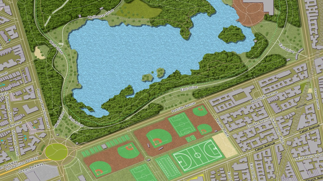
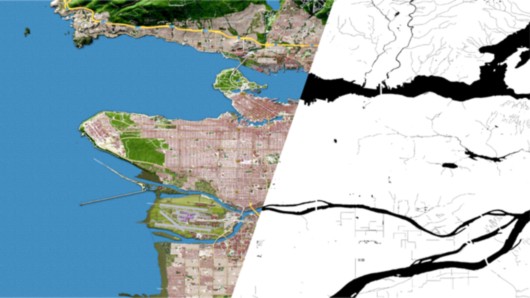
Landmasks, a clear separation between land and sea |
|
|
| From now on, Vasco StreetMaps 14 allows you to switch between the 3 modes at any time without losing the map section and the set color scheme. From single map mode to tile mode and back again, no problem. For example, first, create an overview map in single map mode before creating a huge map in tile mode. |
With the new land mask function, you can automatically generate
black-and-white maps that clearly distinguish between land and water. These
masks can be used directly in Vasco da Gama to make your animations even
more realistic. This means that water is only simulated where there are
actually seas, lakes, or rivers - while land areas remain cleanly excluded.
The result: precise boundaries, natural-looking animations, and a much more
professional overall impression of your projects. |
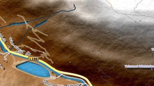
More structures with the Perlin Noise Engine
|
|
|
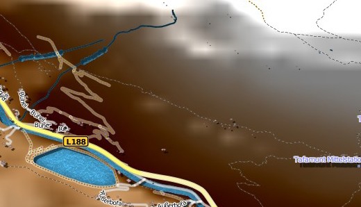
Without Perlin Noise |
With Perlin Noise |
The Perlin Noise Engine makes the mountain landscapes of your maps look even more realistic and vivid.
Fine textures, through additional information and improved calculation, are now visible through the Perlin Noise Engine.
GPS database, known from Vasco da Gama

Benefit from better filtering techniques and more ways to find places. The GPS database, already known from Vasco da Gama, now offers even more GPS points from around the world, so you can find even smaller places that were not previously included.
|
Multi-GPS selection to determine a desired map area |
Importing a GPS track to calculate the map area |
|

|
| Select different GPS points from the database, Vasco StreetMaps 14 will automatically calculate the correct map section so that all GPS points are included on the map. |
You have a GPS track and want to have the map area calculated automatically.
No problem, Vasco StreetMaps 14 now imports your GPS track and automatically
calculates the correct map area so that all GPS points from the track are
included in the map area. |
Ocean background, for clean transitions and more beautiful maps
Vasco StreetMaps 14 now offers you 3 different ways to visualize oceans and lakes. Whether colorful in bright shades of blue or in the colors of the deep blue sea with beautiful turquoise areas or simply in a freely selectable color. It's completely up to you.
Loadable colour schemes
Vasco StreetMaps 14 offers you a variety of mapping colour settings, which gives you enormous flexibility. A large number of loadable colour schemes are included for you to quickly try and use, producing thereby elegant map designs. Naturally, these colour schemes can be adapted and saved as additional template.
Important note:
Previous versions of Vasco StreetMaps must not be used in mixed mode (i.e. installed at the same time)! Problems may occur due to a changed data structure. However, older project files from Vasco StreetMaps 10, 11 and 12 can be imported and edited in Vasco StreetMaps 14..
Vasco StreetMaps 14 is delivered as download or on Blu-rays! Therefore a Blu-ray drive is required to install the Blu-rays.
For the download version no Blu-ray drive is required.
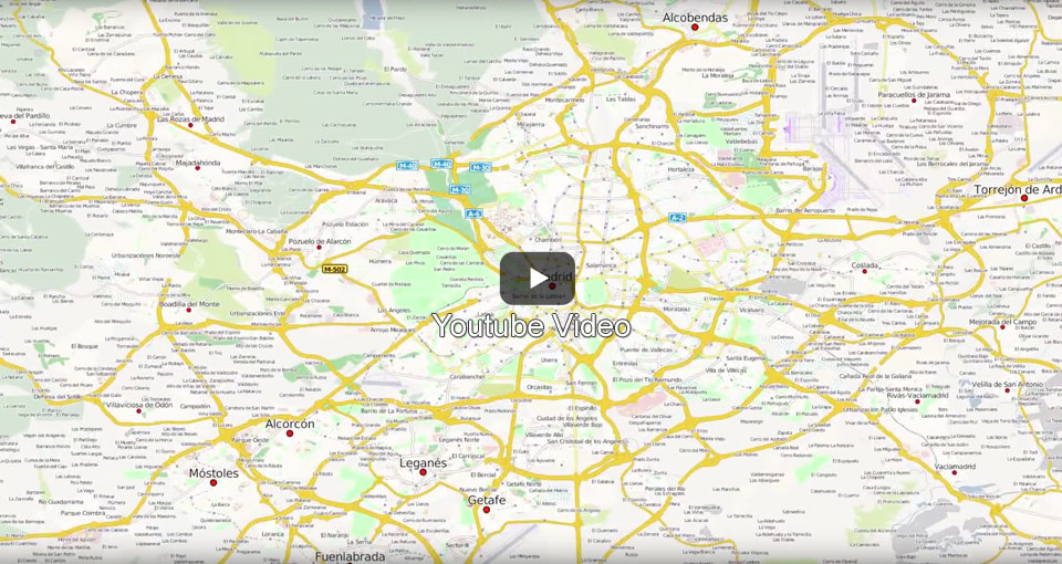
Vasco StreetMaps - Video
Romantic encounter in London
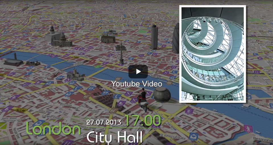
In this video, we show an example of how precisely and effectively Vasco StreetMaps 3 maps can be used in Vasco da Gama 7. The geo-information of the maps is retained despite post-processing in a graphics program. This enables exact route guidance with individually designed map material. In addition to Vasco StreetMaps 3 and Vasco da Gama 7 HD Professional, the object package "Sights of Europe" was used.
Features
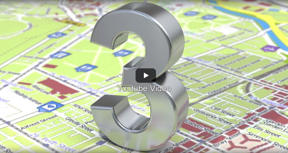
Version 3 of Vasco StreetMaps offers a wide range of new features and data. The map design has become even more flexible. In addition, it is possible to load and edit the Vasco StreetMaps 3 maps in a graphics program before importing them into Vasco da Gama, without losing the GPS - data. Create your own maps for Vasco da Gama or for individual use as a stand-alone solution.
A journey from Frankfurt to Cologne
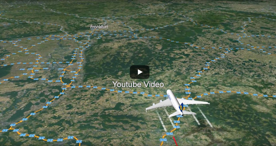
In this video example we show how the maps of Vasco StreetMaps 2 can be used within Vasco da Gama 6, 7,8, 9 (or even Vasco da Gama 5) to create detailed travel animations. Maps were created in different resolutions and transparencies to achieve exactly the level of detail that looks best depending on the mode of travel (plane, car, on foot). In addition, SatMap Professional Germany, Blue Marble NG and various object packages were used.
Demonstration of the zoom factor setting
In this video we show how flexible the resolution can be set when creating maps with Vasco StreetMaps 2. You can generate maps of entire continents as well as high-resolution street maps, setting in detail how exactly the maps should look.
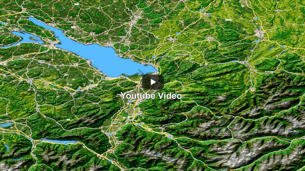
Example maps Vasco StreetMaps
The maps were created with a lower JPG quality, so that the
file size is as small as possible and thus the downloading takes place faster.
| Fonts |
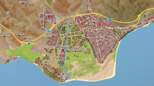
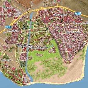
Gran Canaria - Maspalomas |
Gardasee
|
 |
 |
 |
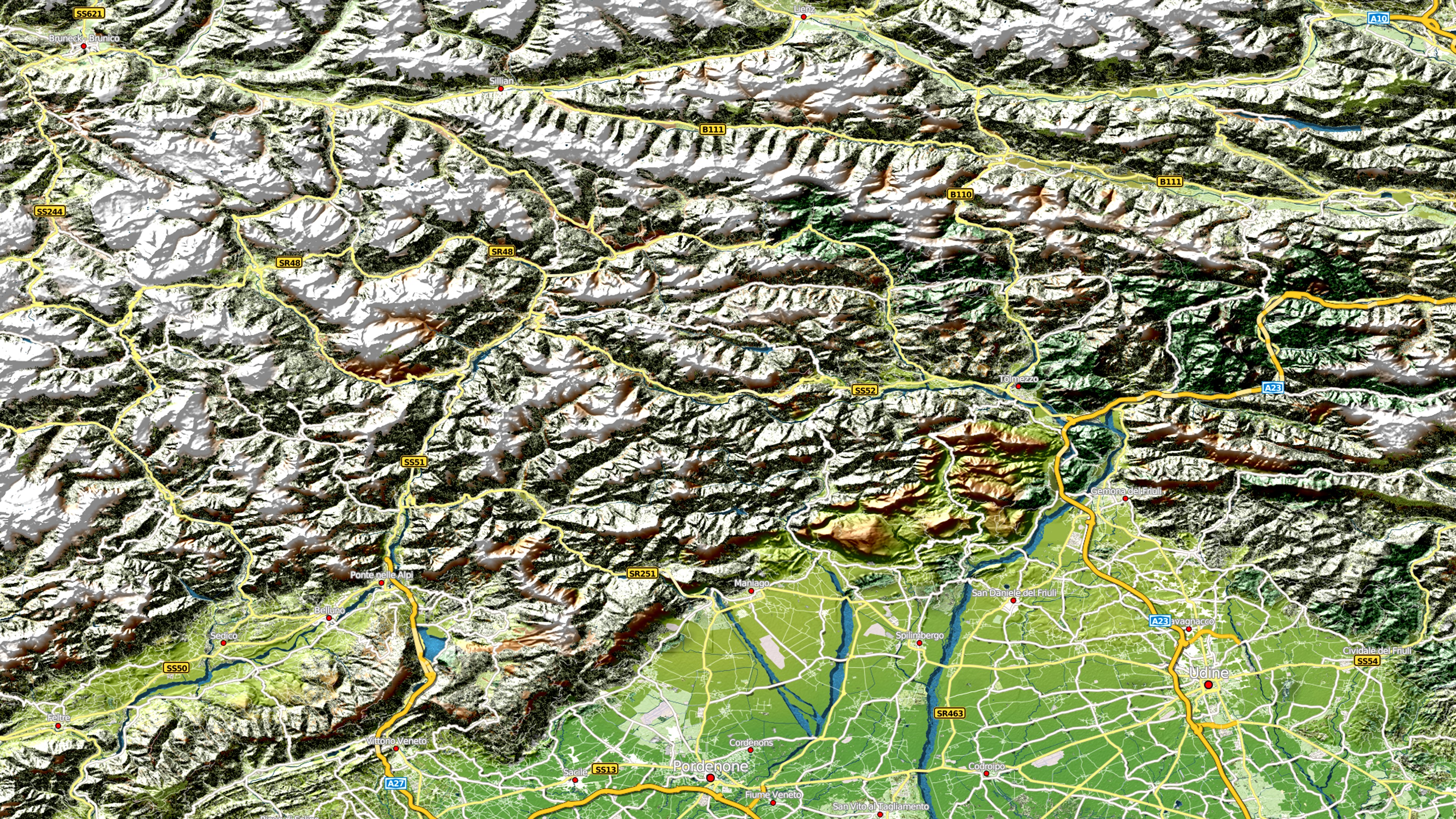
| Alpen |
Bodensee |
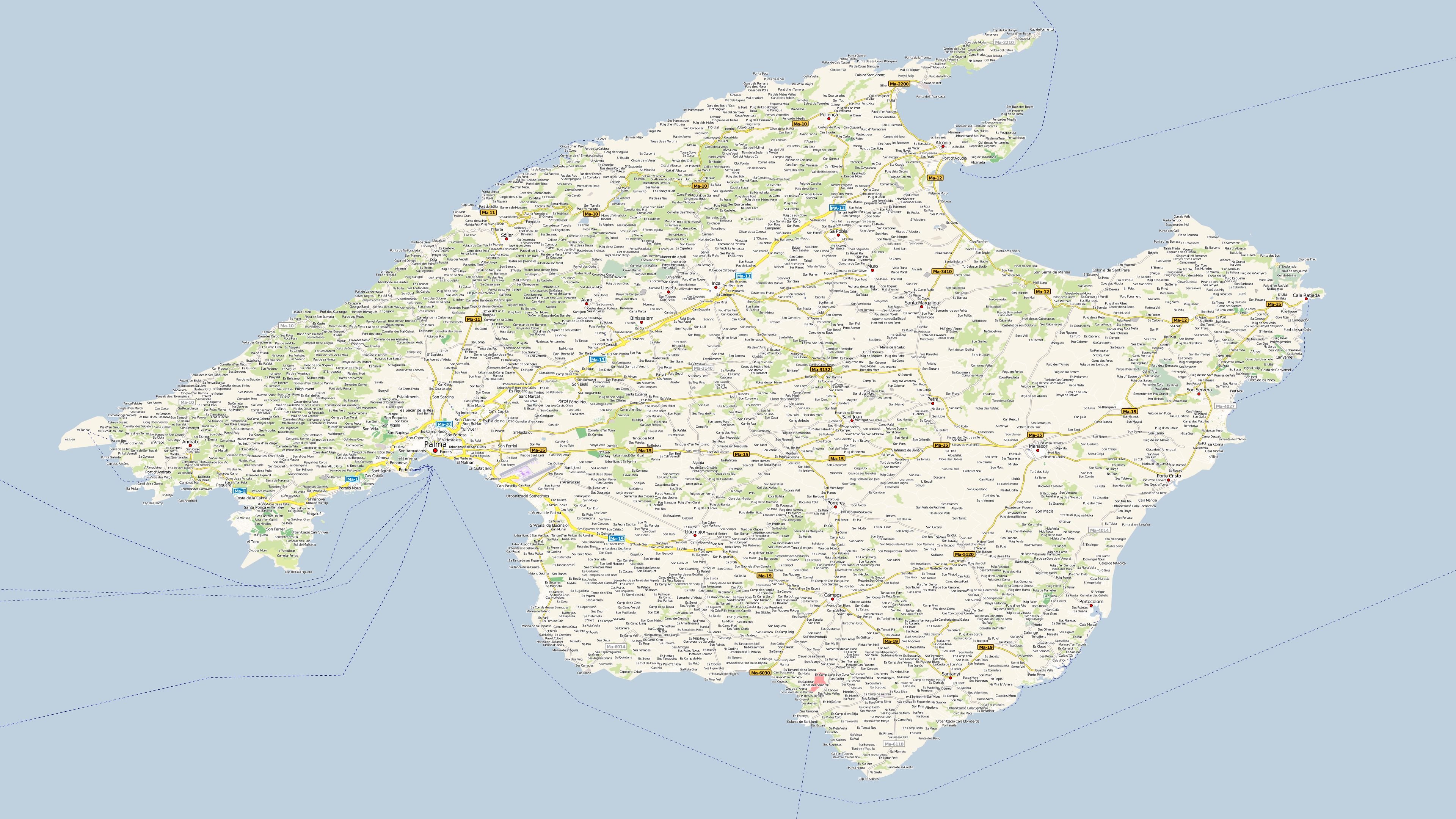
Mallorca
|
 |
 |
 |
|
Map size: 3840x2160 |
Map size: 3840x2160 |
Map size: 3840x2160 |
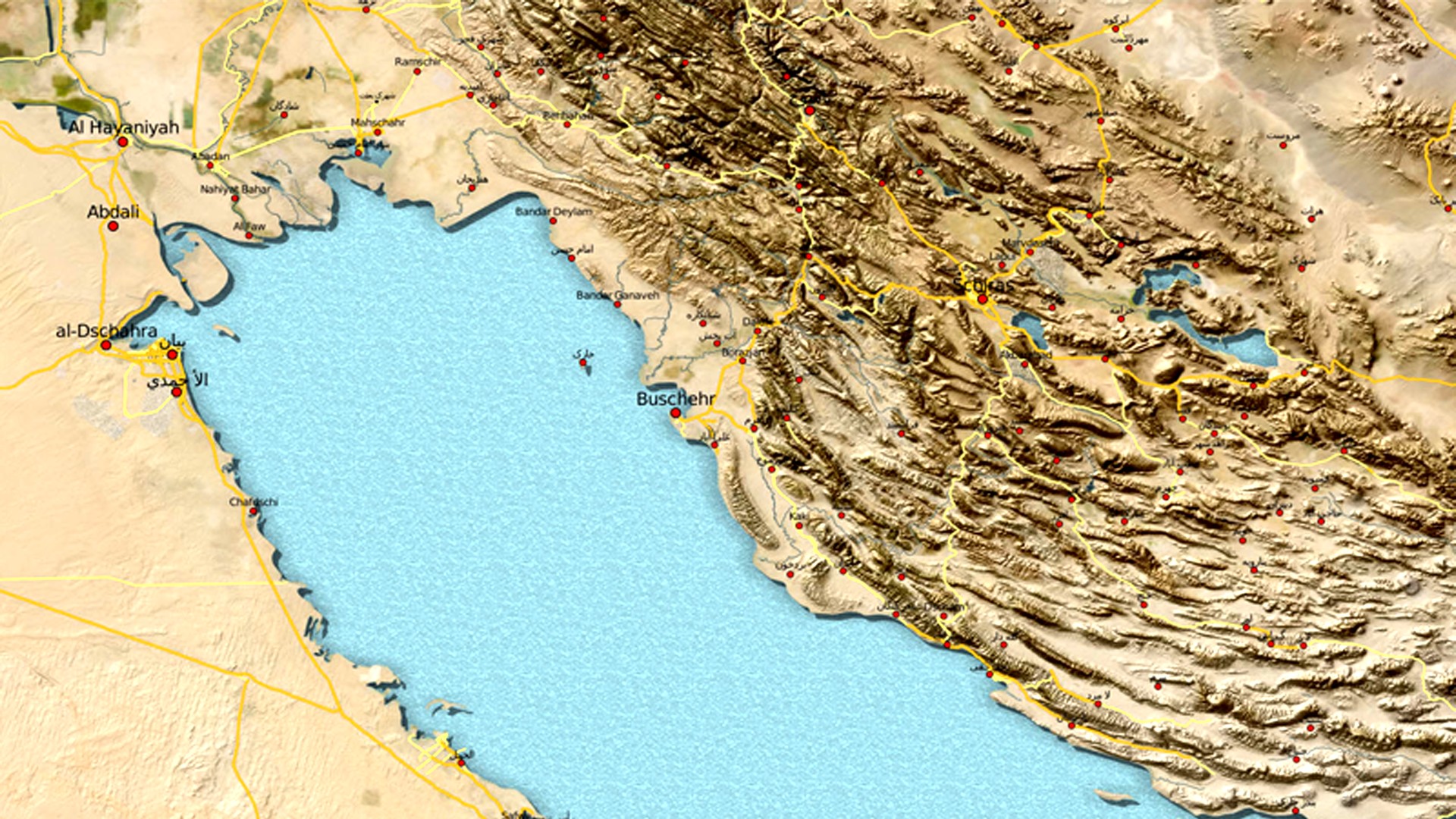
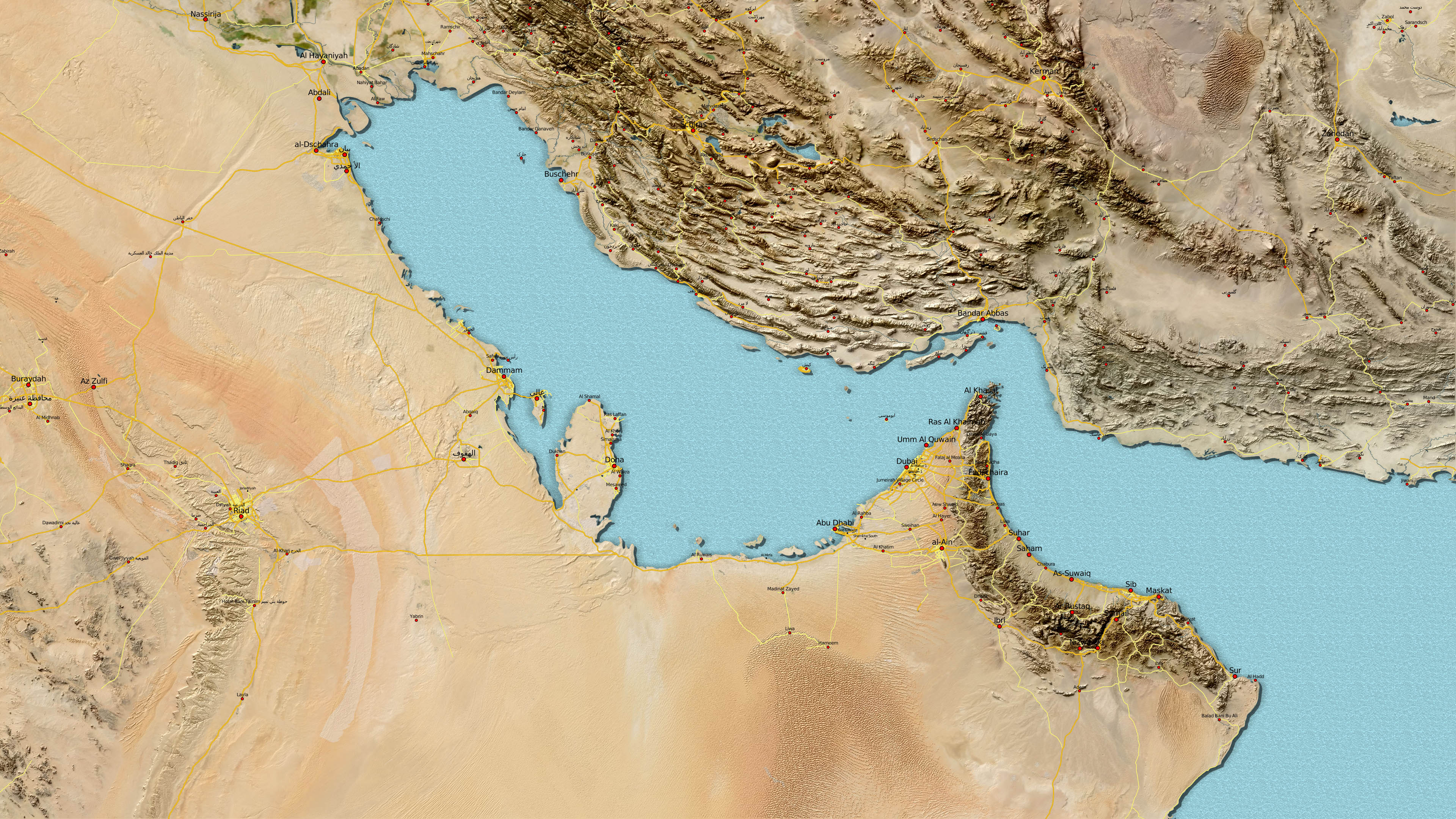
| Persischer Golf |
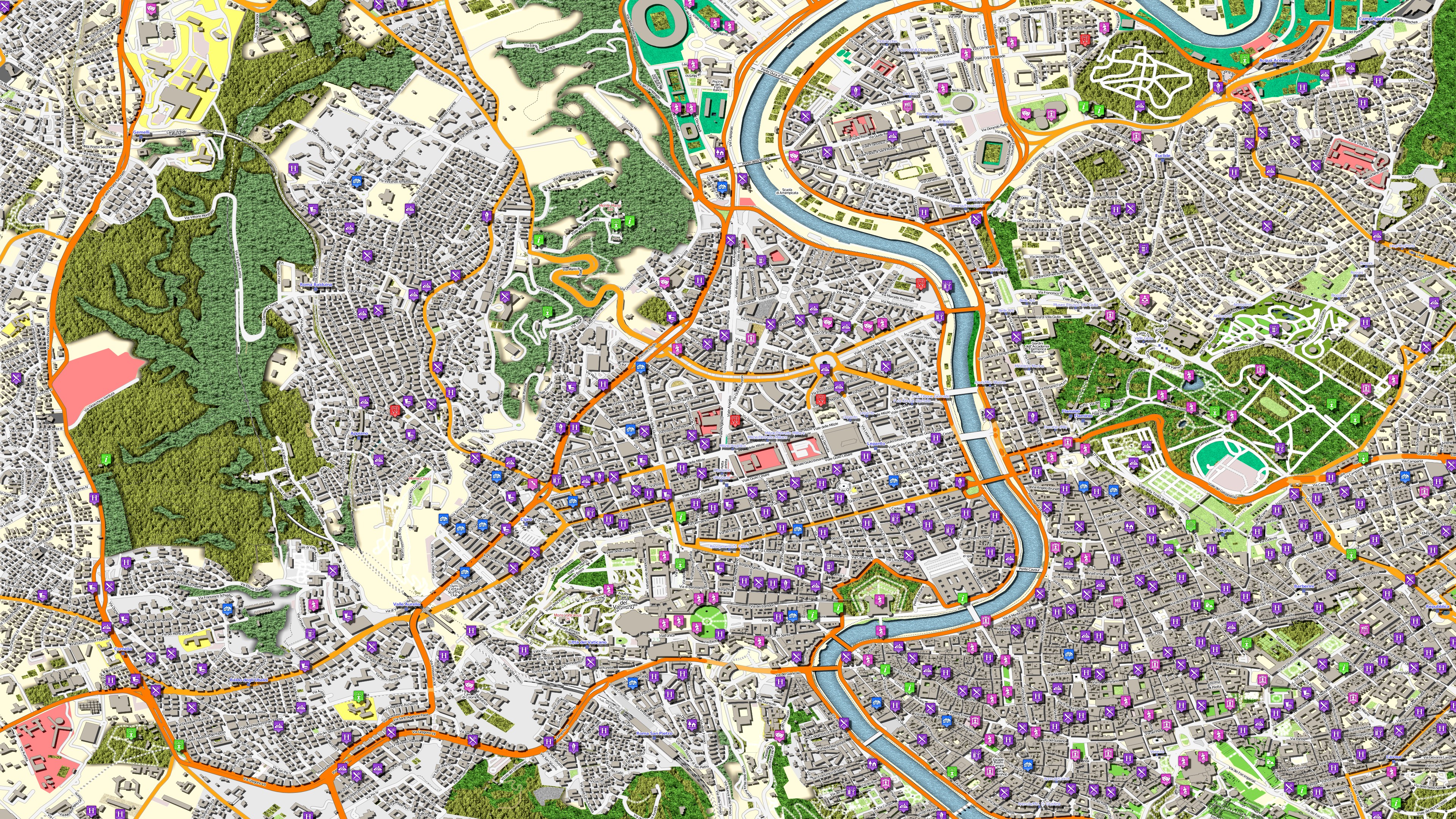
Rom |
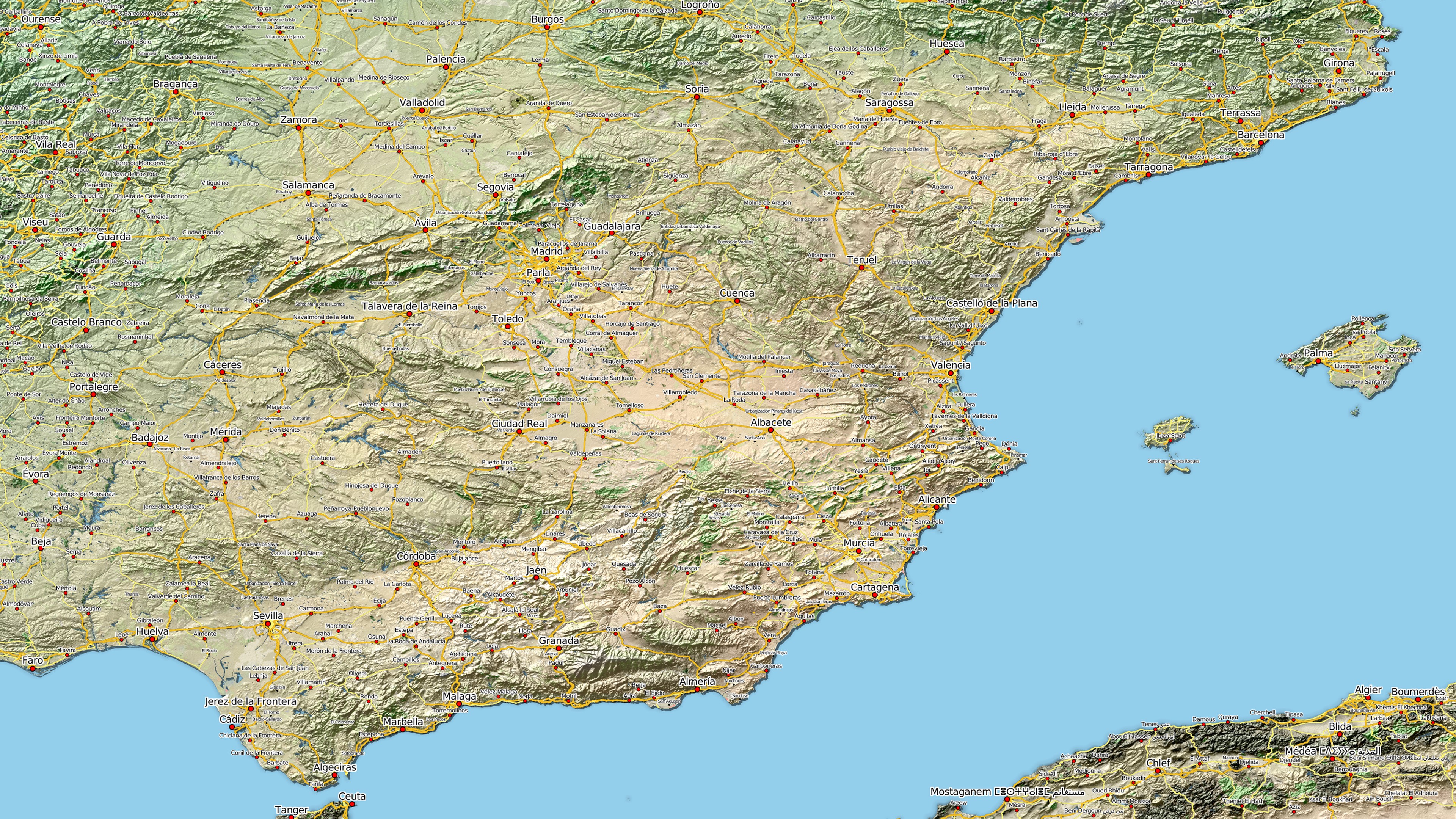
Spanien
|
 |
 |
 |
|
Map size: 1920x1080 |
Map size: 3840x2160 |
Map size: 3840x2160 |
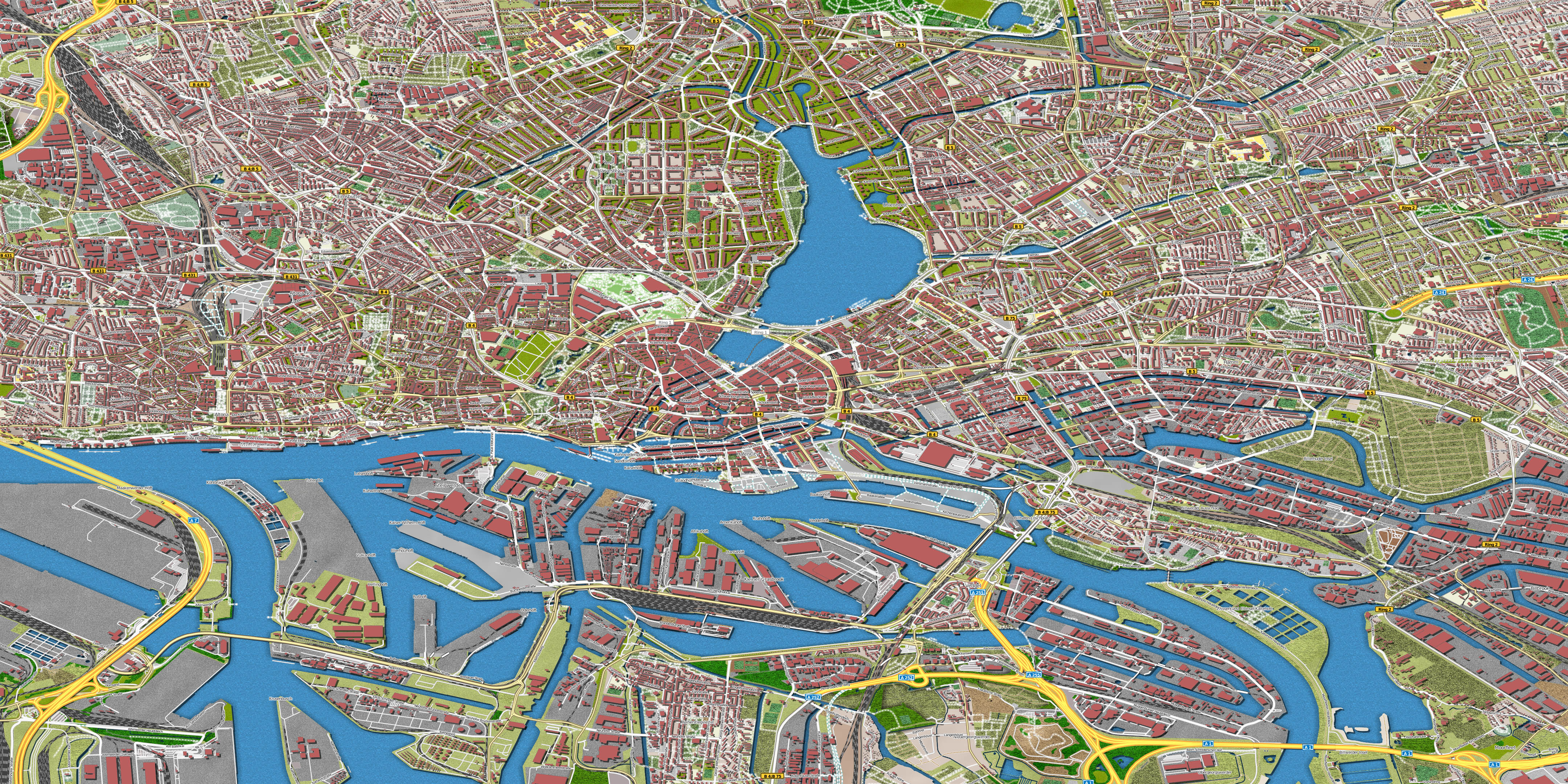
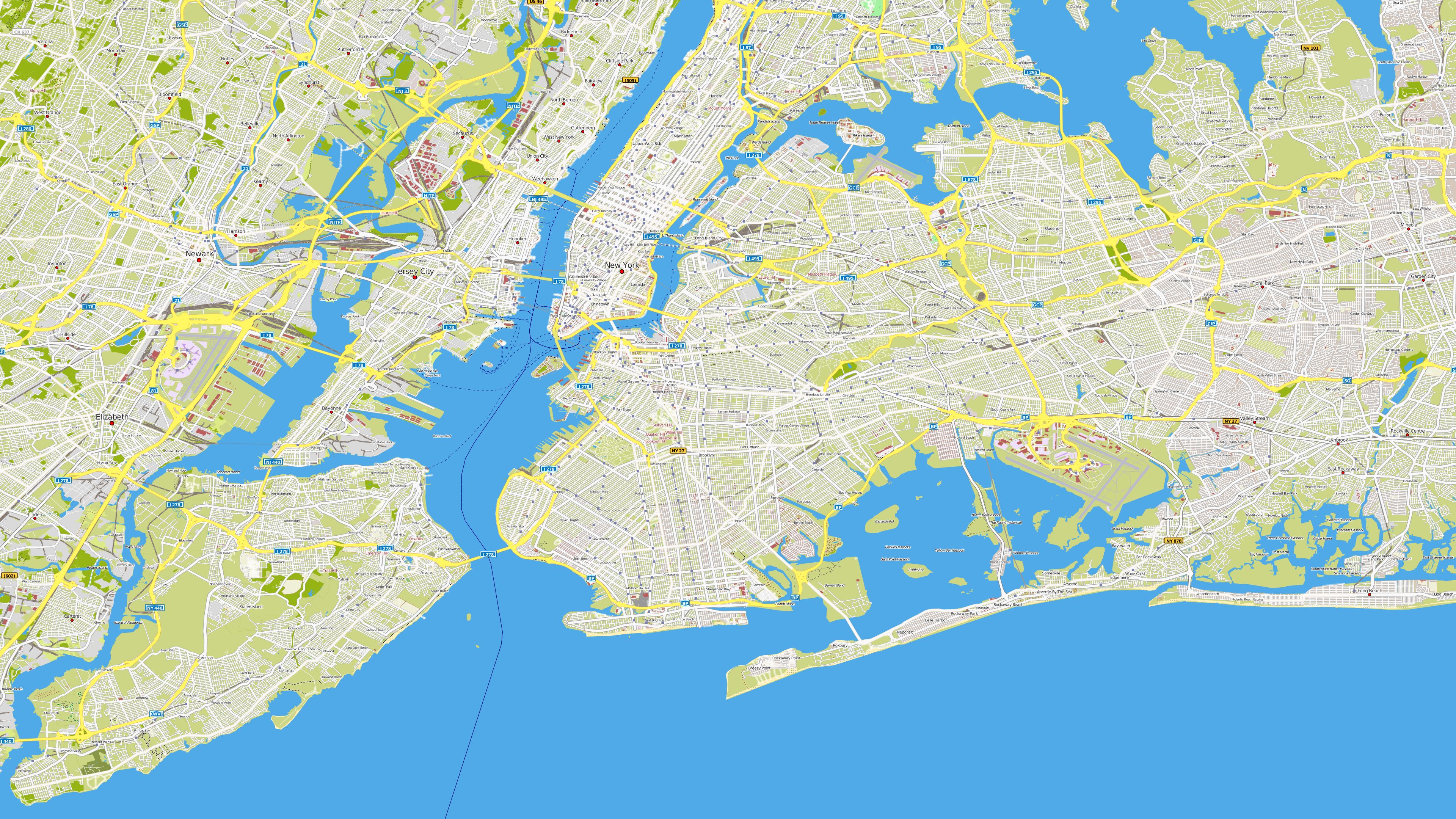
| Hamburg |
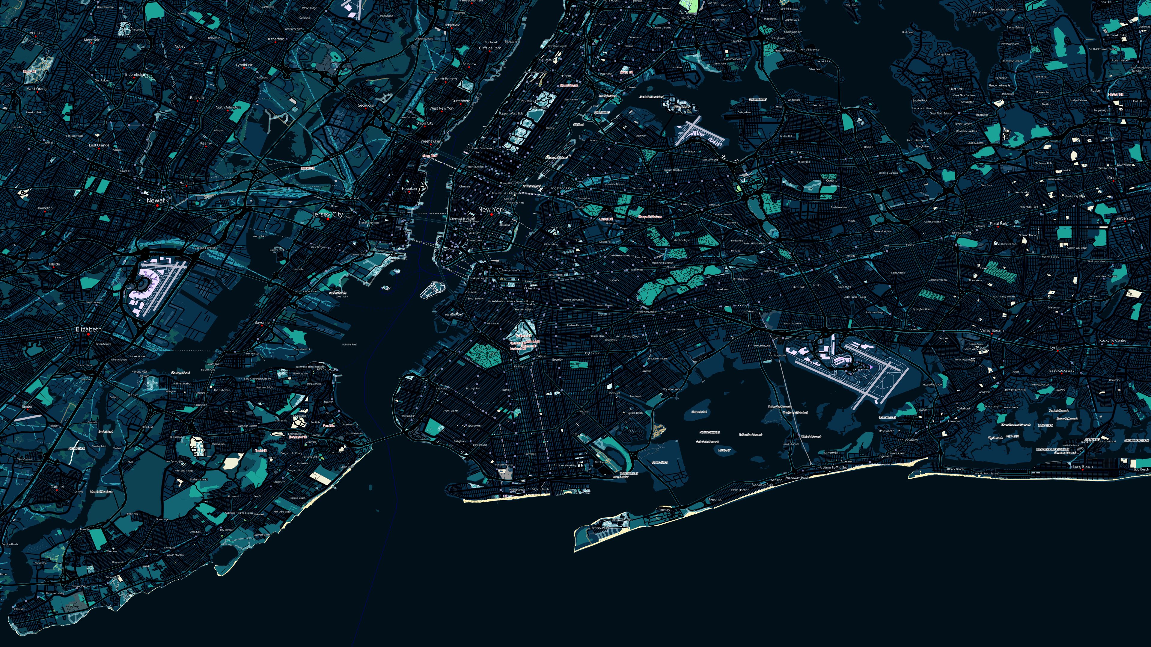
New York
bei Nacht |
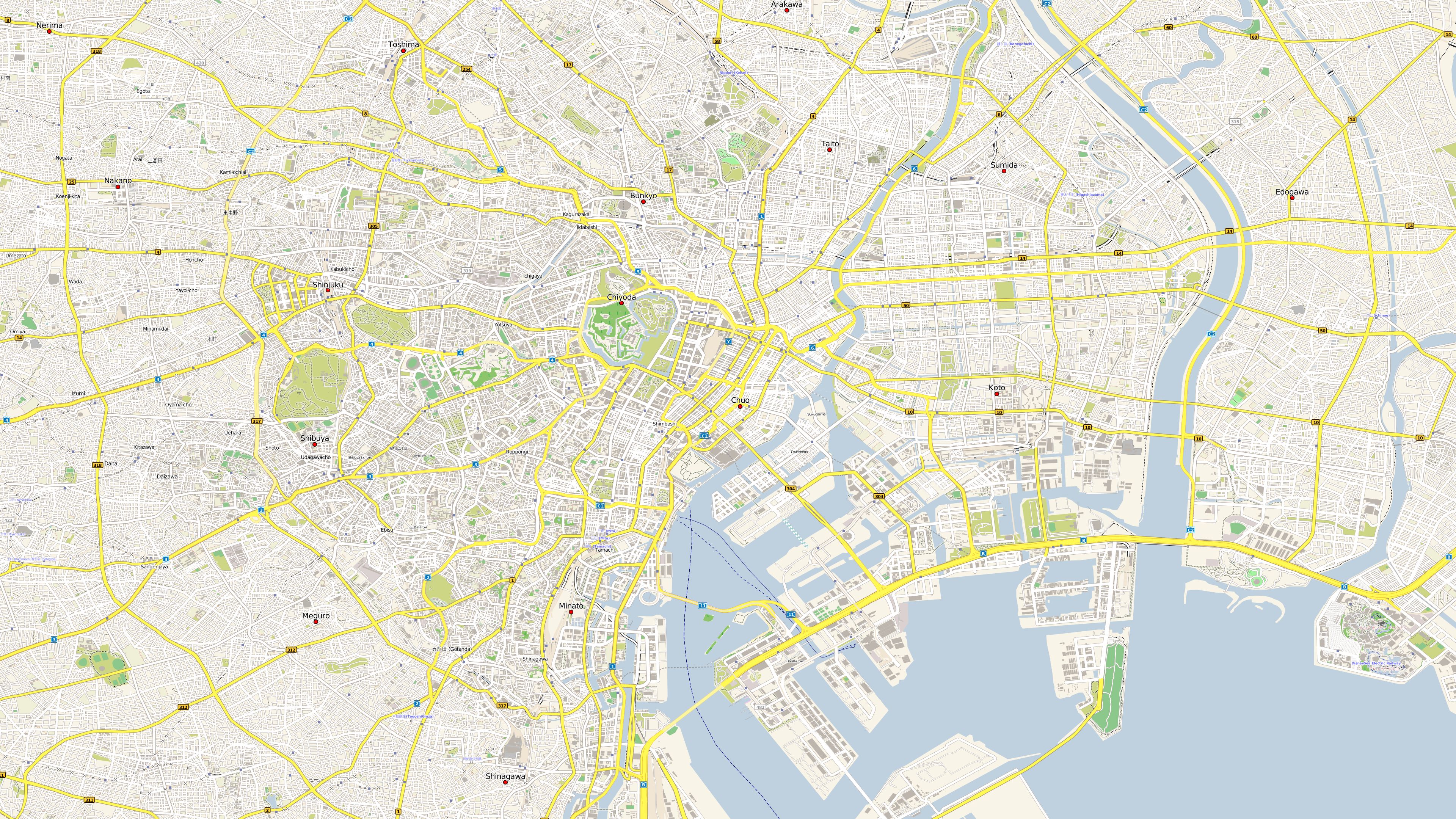
Tokyo |
 |
 |
 |
|
Map size: 4320x2160 |
Map size: 3840x2160 |
Map size: 3840x2160 |
|
|
||
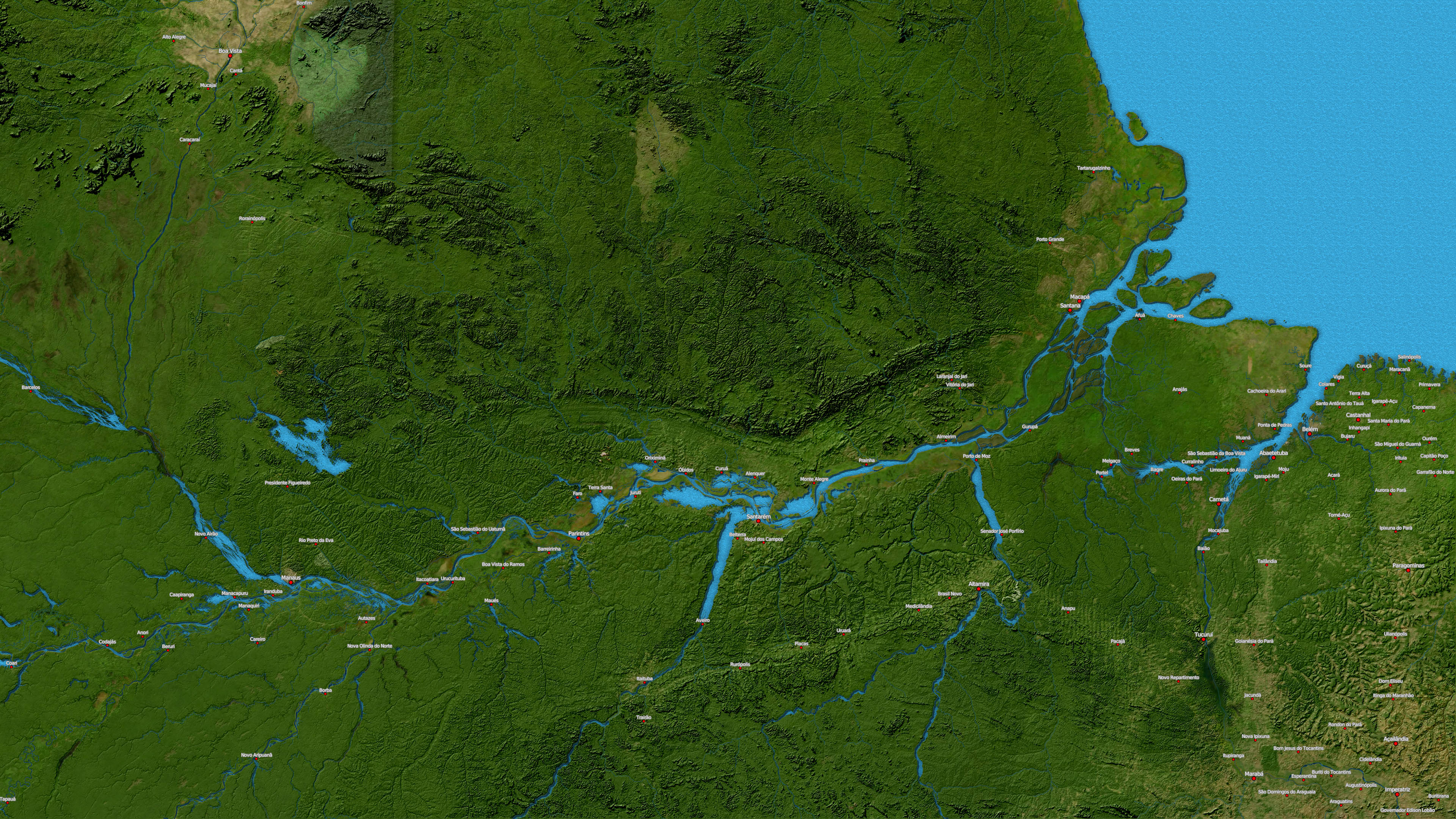
| Amazonasgebiet |
Bremen |
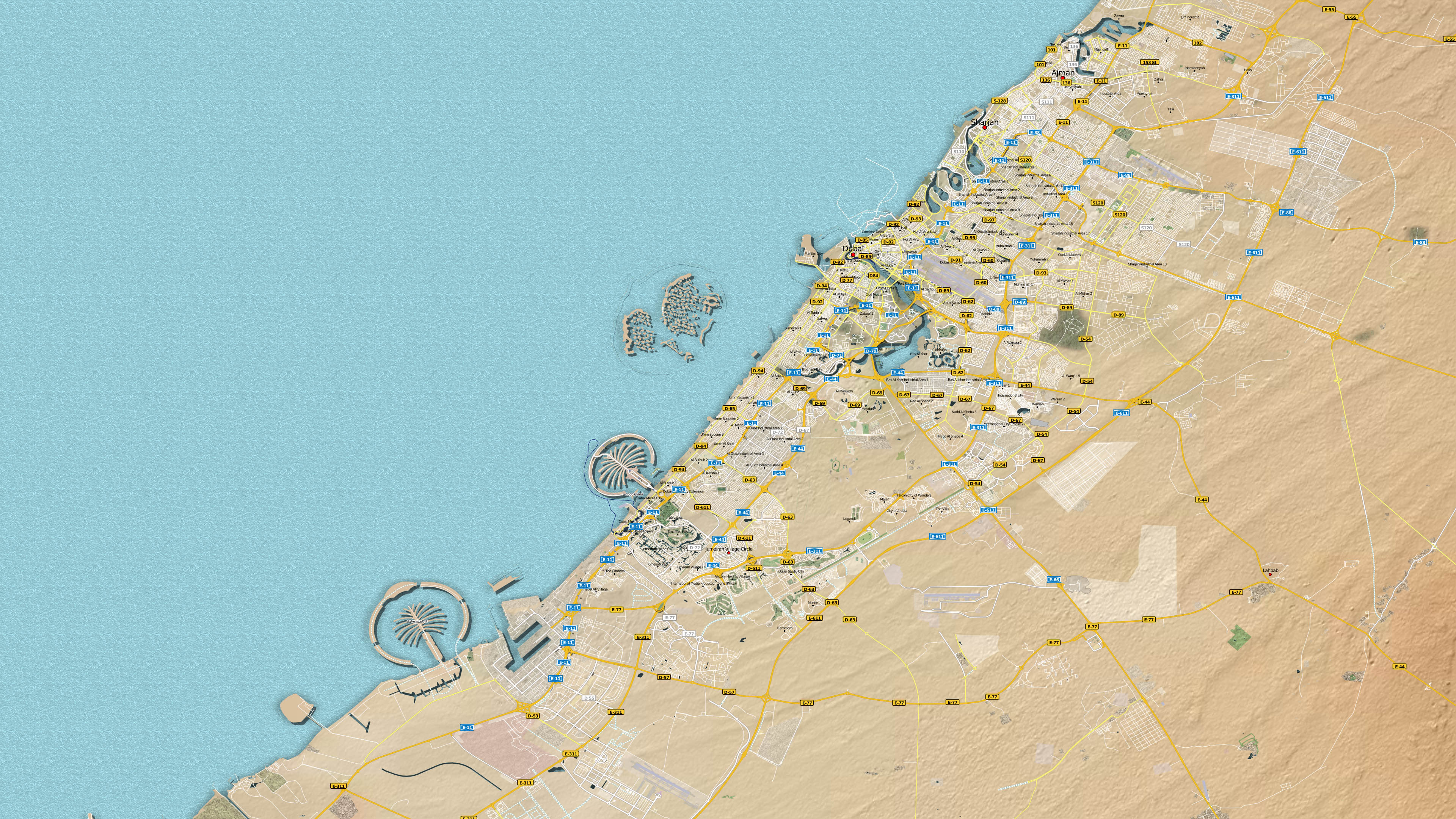
Dubai |
 |
 |
 |
|
|
|
|
|
||
|
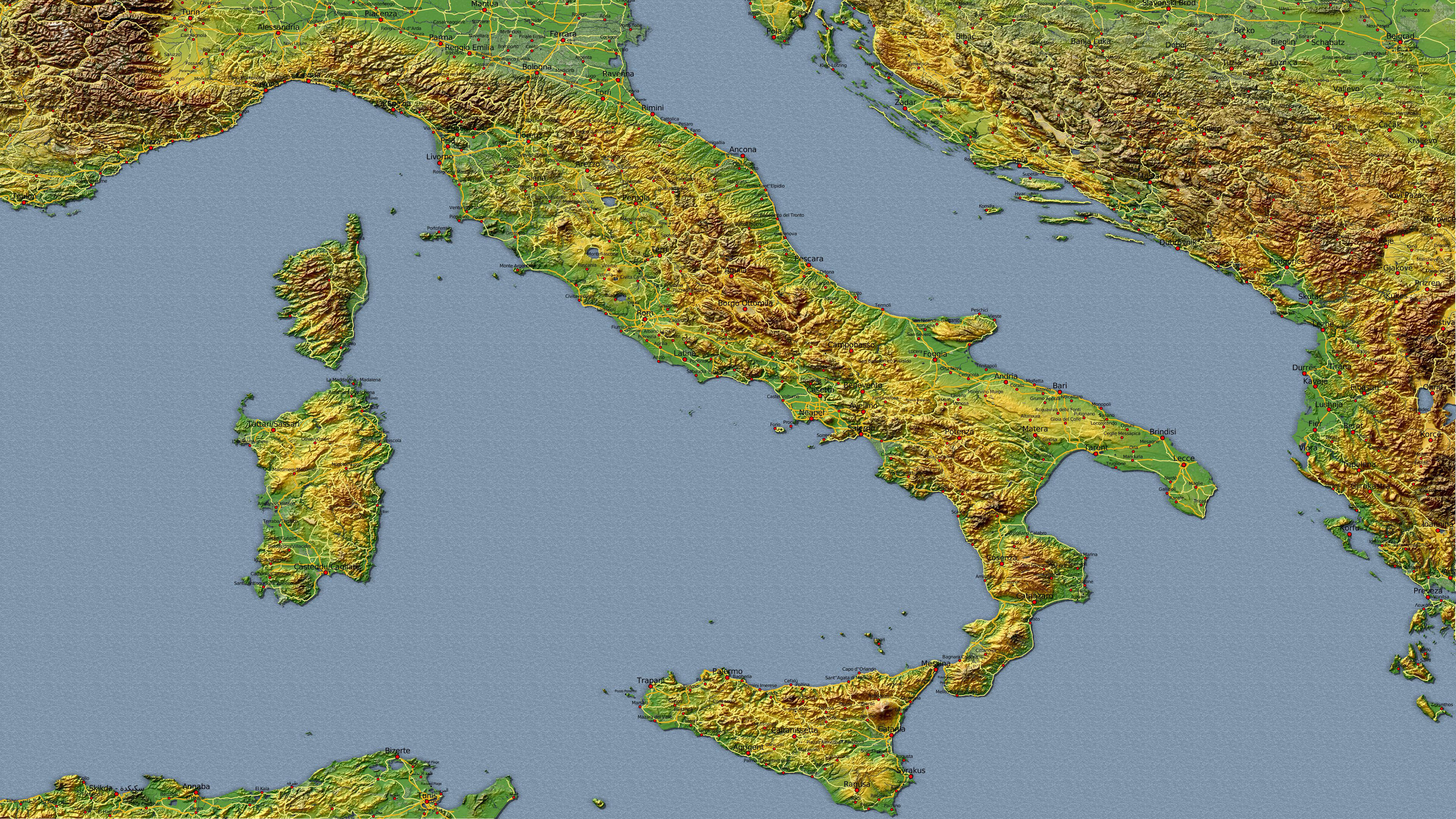
Italien Kombinationsbeispiel 1 mit Satelliten-, Höhen- und Vektordaten |
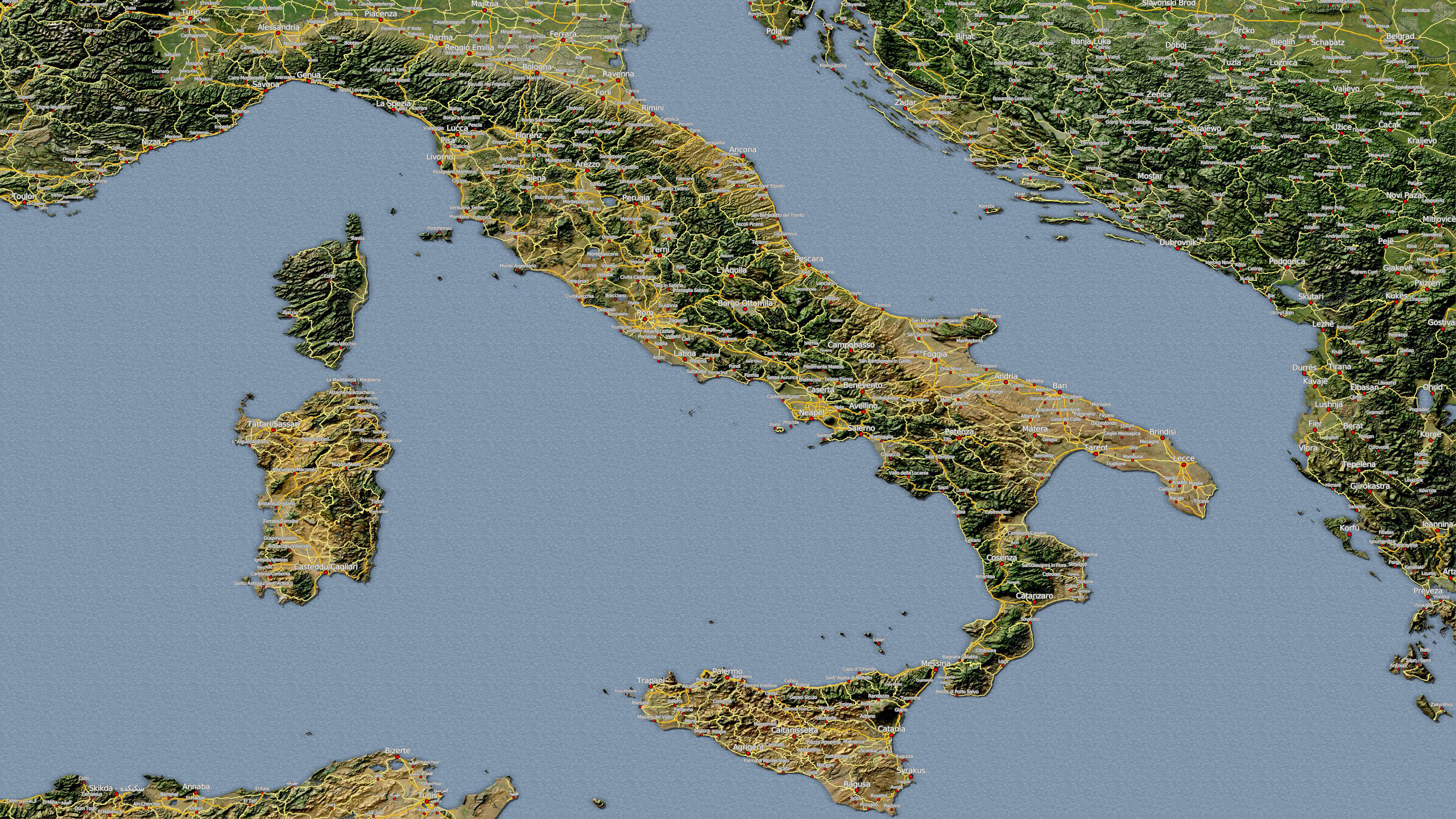
Italien Kombinationsbeispiel 2 mit Satelliten-, Höhen- und Vektordaten |
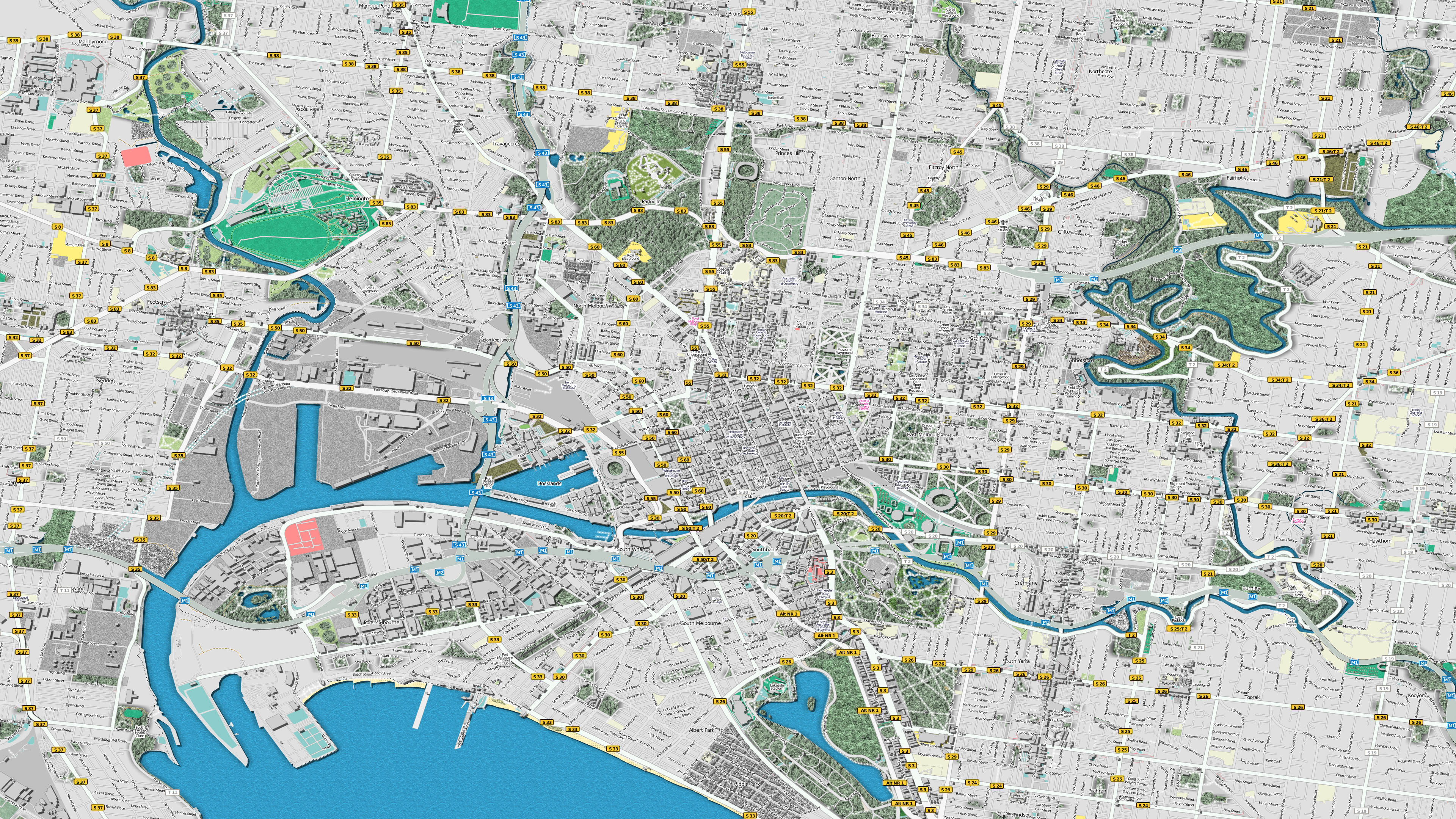
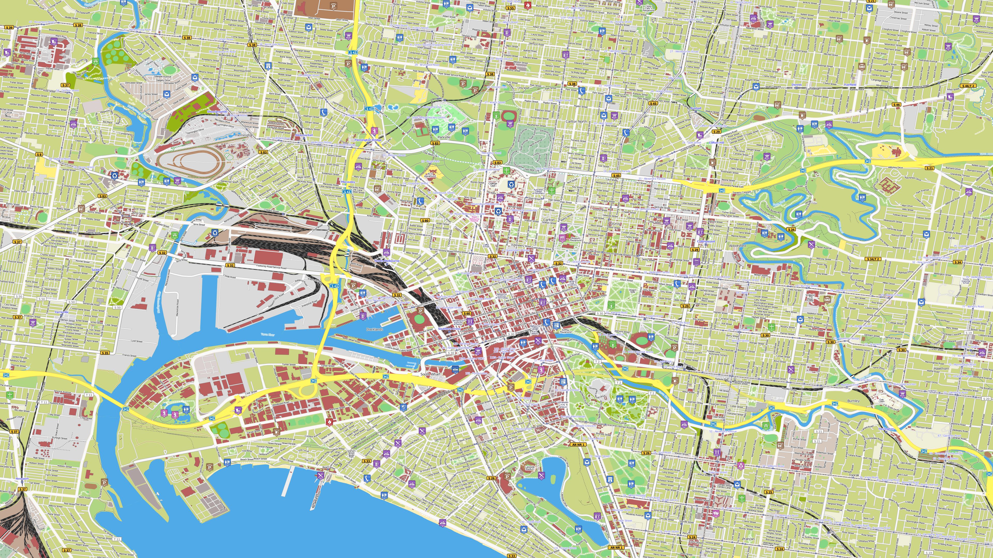
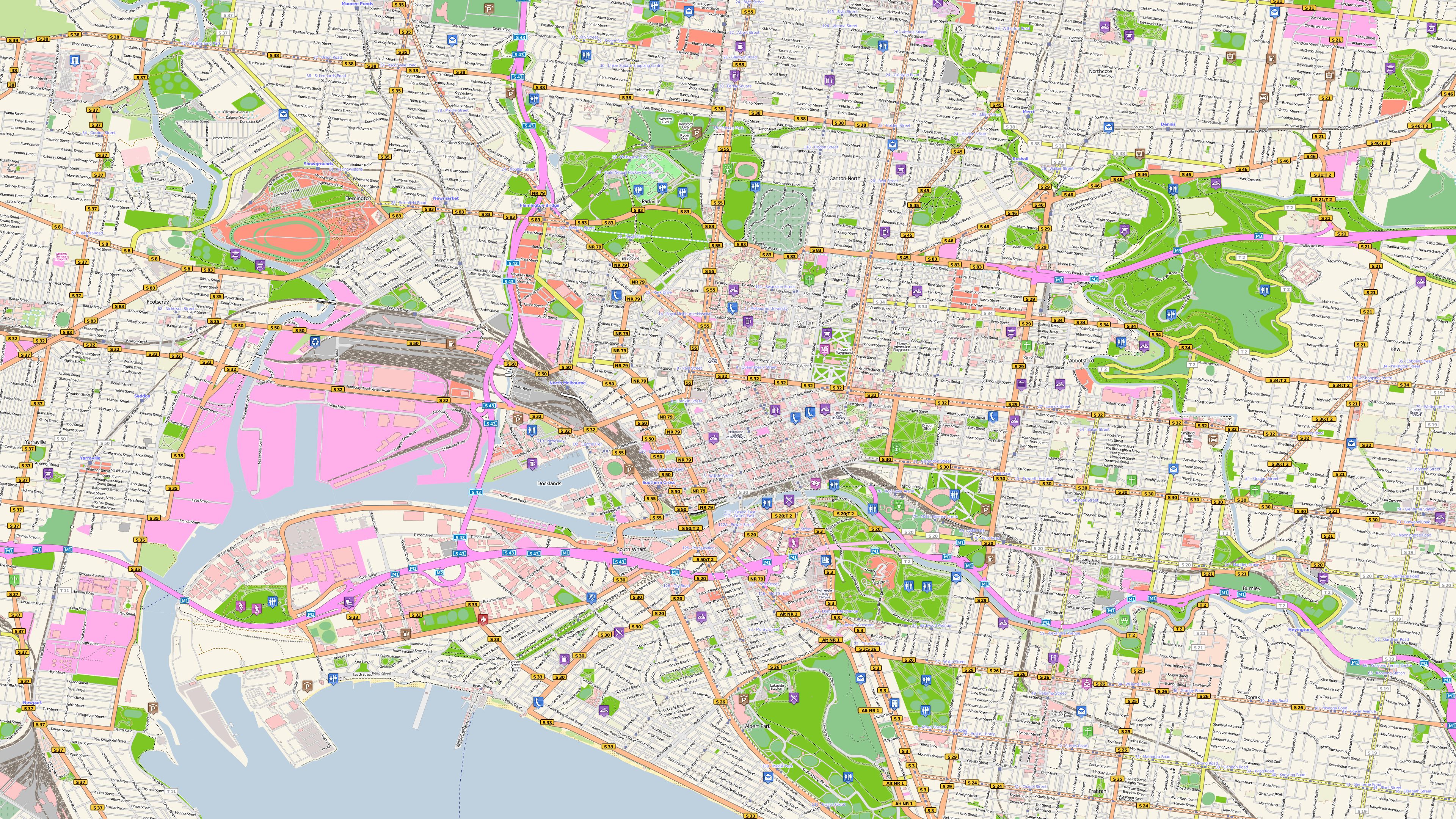
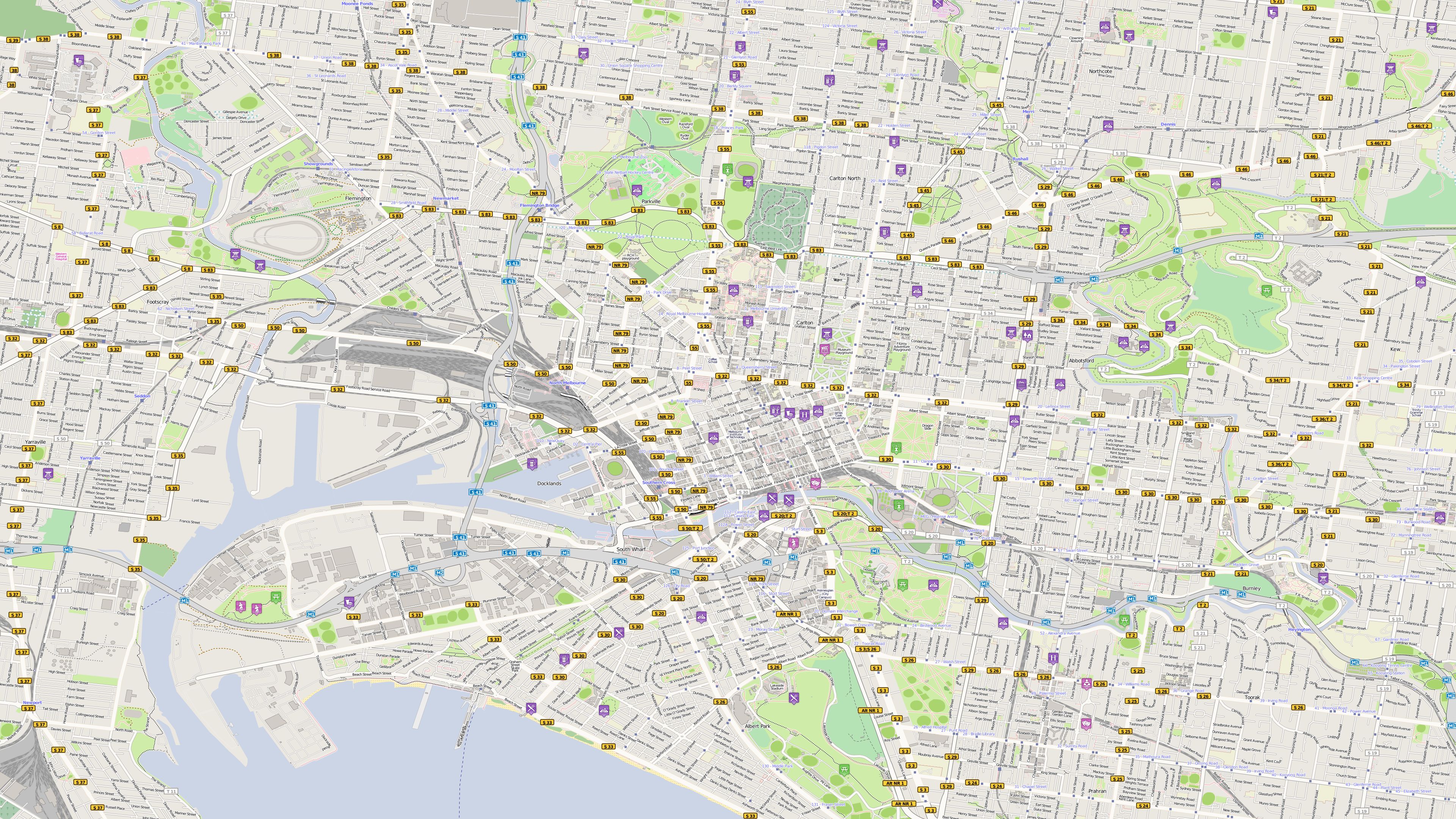
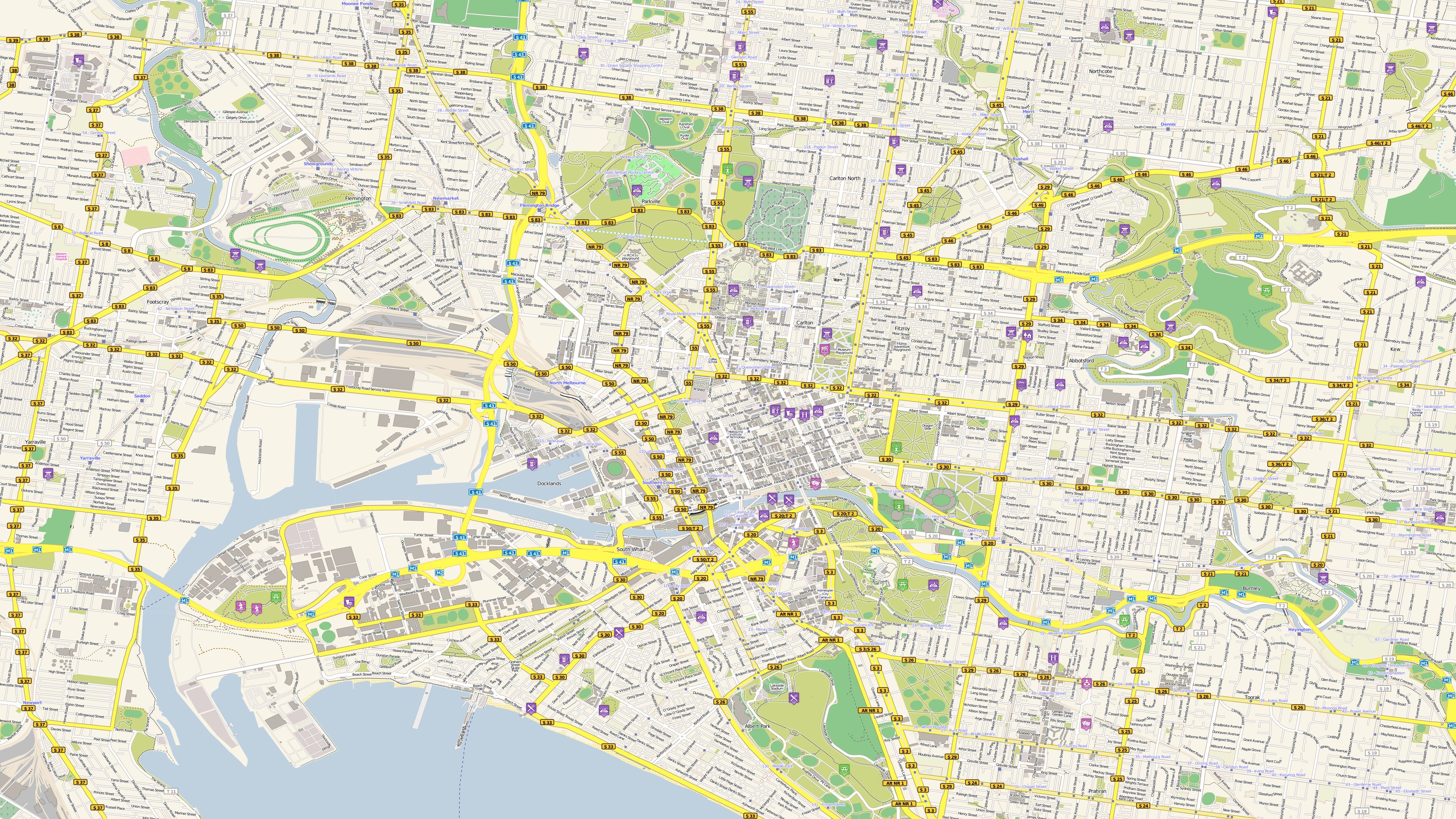
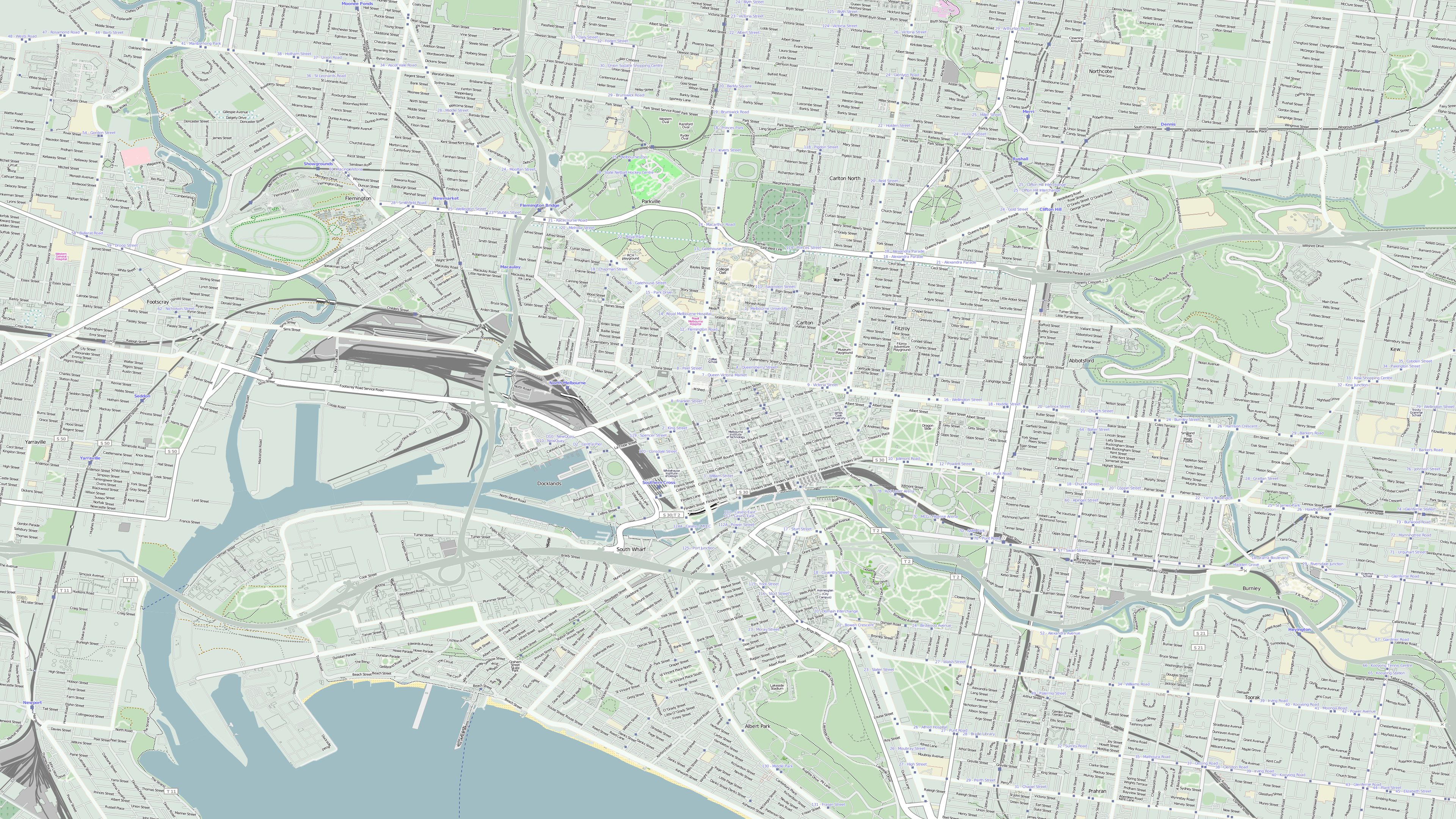
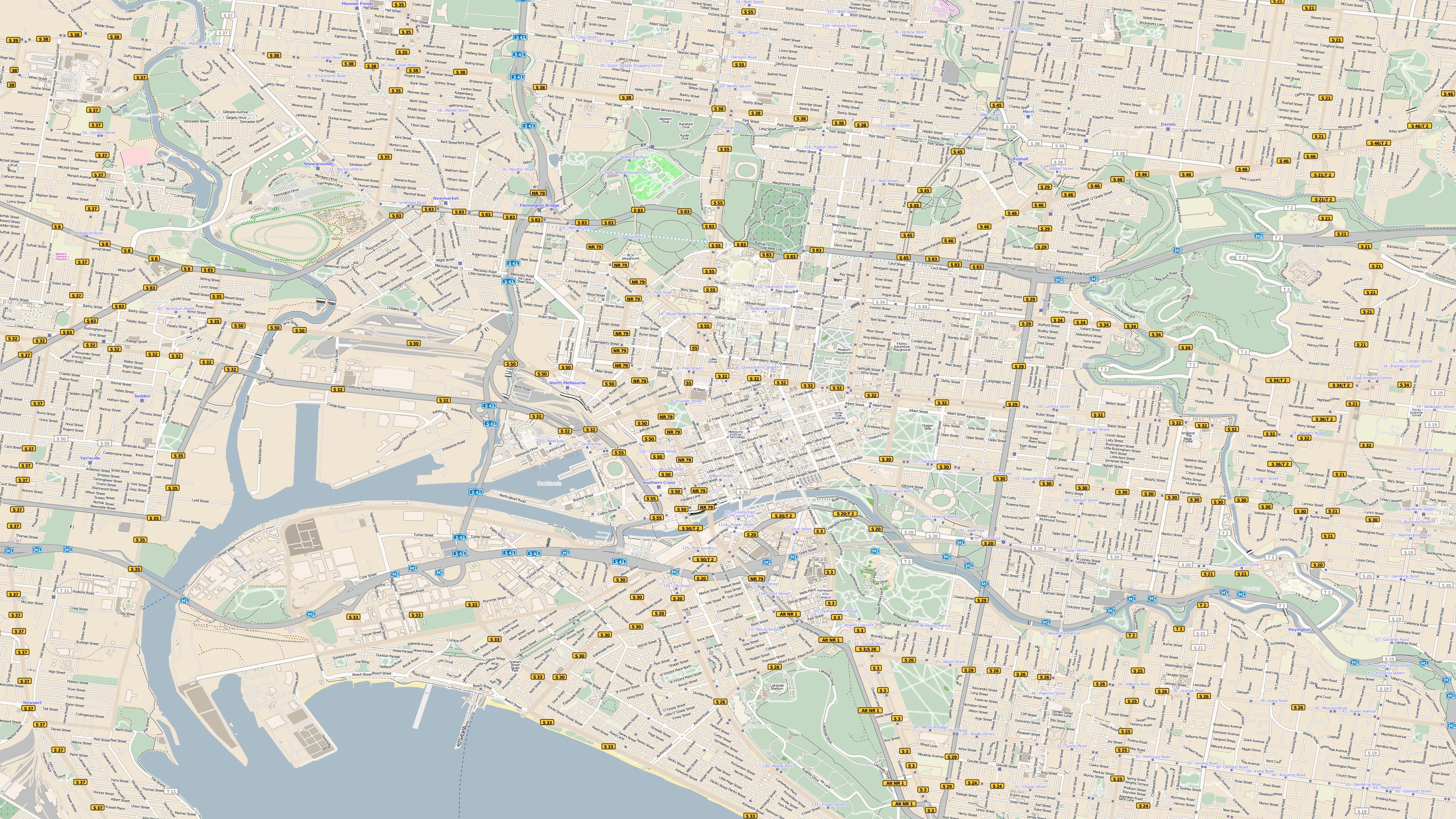
Melbourne |
 |
 |
 |
|
|
|
|
|
||
| Melbourne |
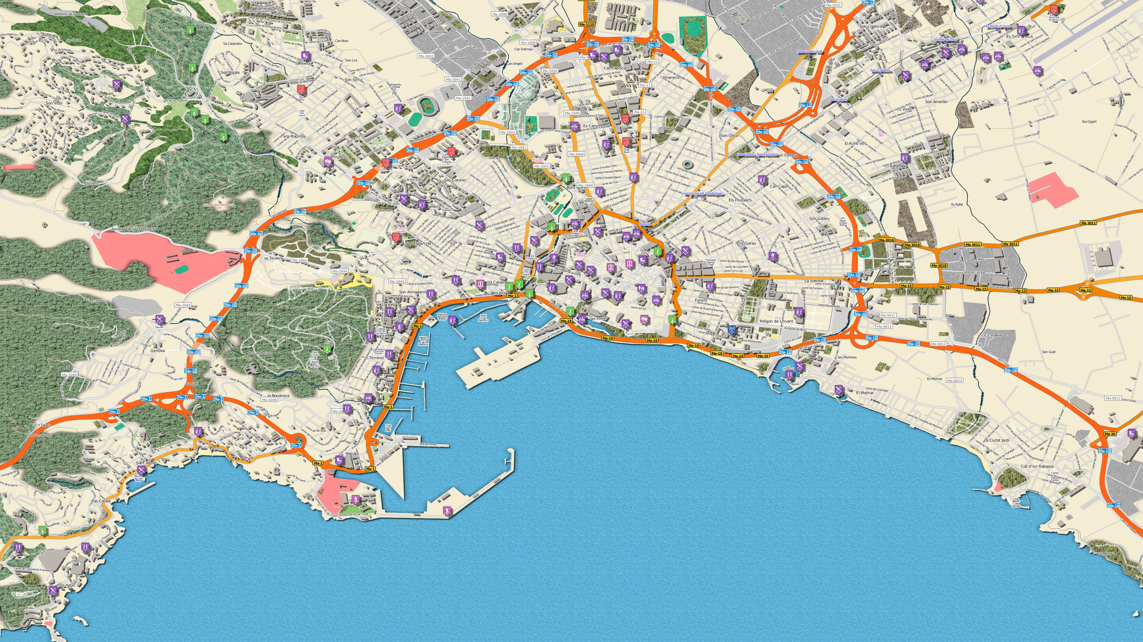
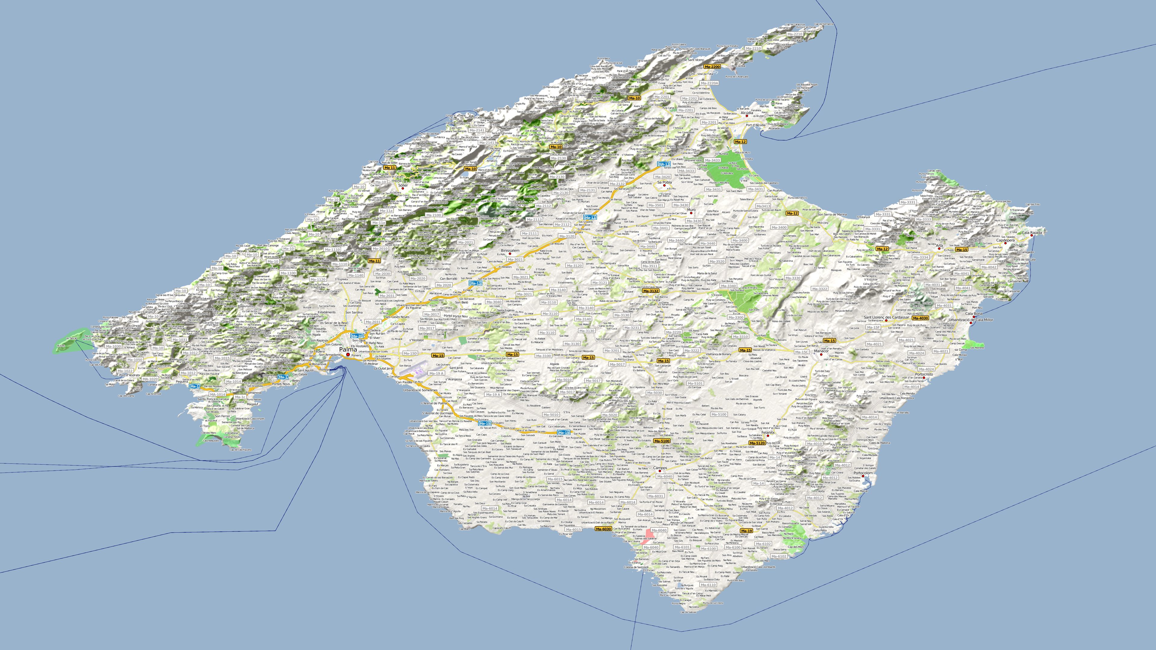
Palma de Mallorca |
Persischer Golf |
 |
 |
 |
|
|
|
|
|
||
| Amazonasgebiet |
Alpen Kombinationsbeispiel 1 mit Höhendaten |
Alpen mit Schnee Kombinationsbeispiel 2 mit Höhendaten |
 |
 |
 |
|
|
|
|
|
||
|
Europa mit deutschen Ortsnamen |
Europa mit internationalen Ortsnamen |
New York am Tage |
 |
 |
 |
|
|
|
|
|
||
| Mallorca |
Mallorca |
Melbourne, Farbbeispiel "Candy" |
 |
 |
 |
|
|
|
|
|
||
|
Melbourne, Farbbeispiel "Fancy" |
Melbourne, Farbbeispiel "Frisches Gelb" |
Melbourne, Farbbeispiel "Mintgrün" |
 |
 |
 |
|
|
|
|
|
||
|
Melbourne, Farbbeispiel "Pastelbraun" |
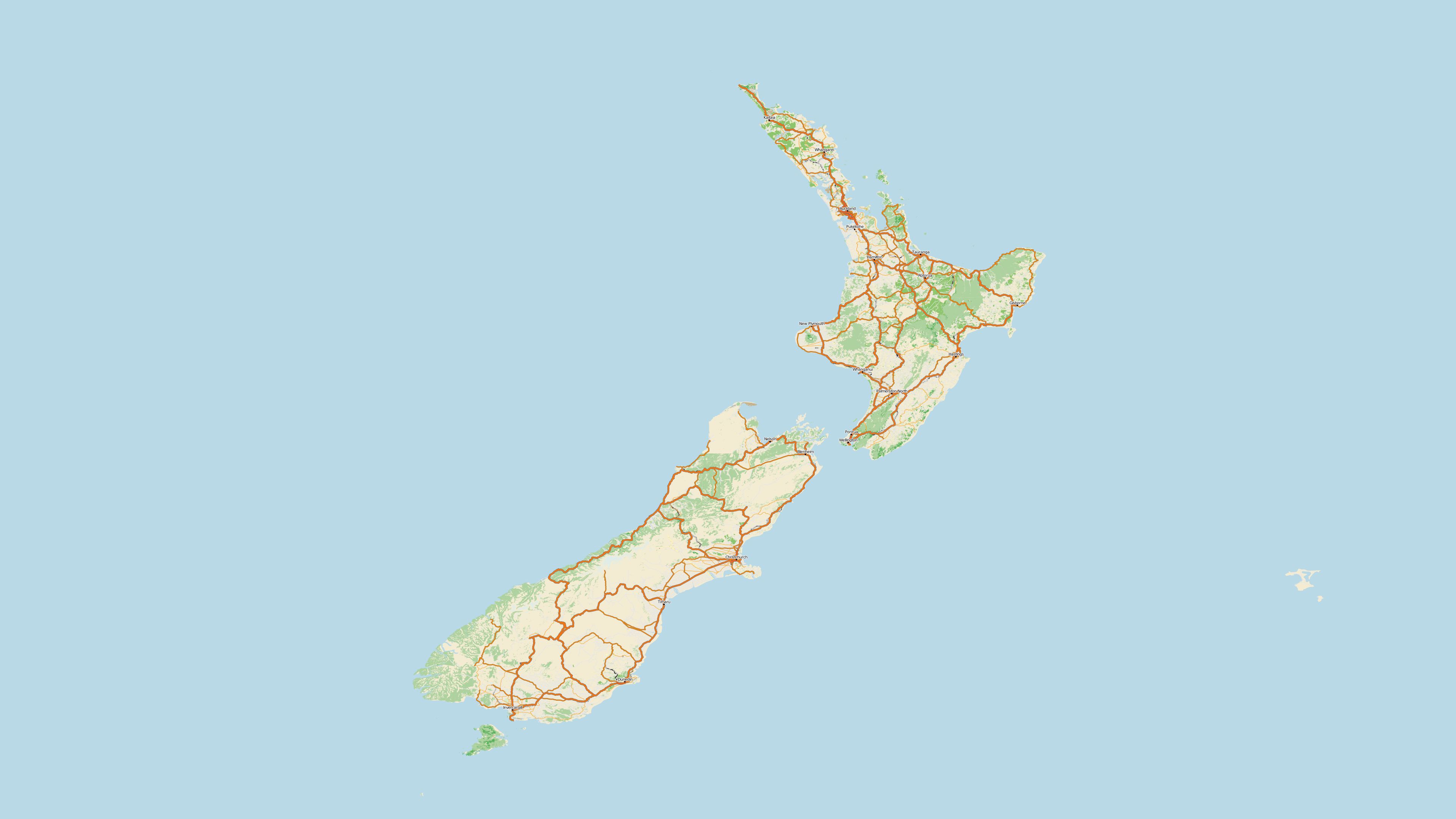
Neuseeland |
|
 |
 |
|
|
|
|
|
|
- Intel® Pentium® IV 1200 MHz or higher
- Microsoft® Windows 7 64Bit, Windows 8 64Bit, Windows 10 64Bit und Windows 11 64Bit
- 16 GByte RAM or higher
- approx. 350 GByte disc space for program installation
- Vasco StreetMaps 14 is delivered as download or on Blu-rays! Therefore a Blu-ray drive is required to install the Blu-rays.
For the download version no Blu-ray drive is required.
- To get maximum performance, we recommend using an SSD hard drive.
You might also be interested in


Learning course Vasco StreetMaps

SatMapPro 2


Vasco da Gama 19 HD Ultimate
Other customers have also bought the following items

Aircraft and airline companies 7
Vasco da Gama 19 HD Ultimate
Upgrade Vasco da Gama 19 HDPro XXL
